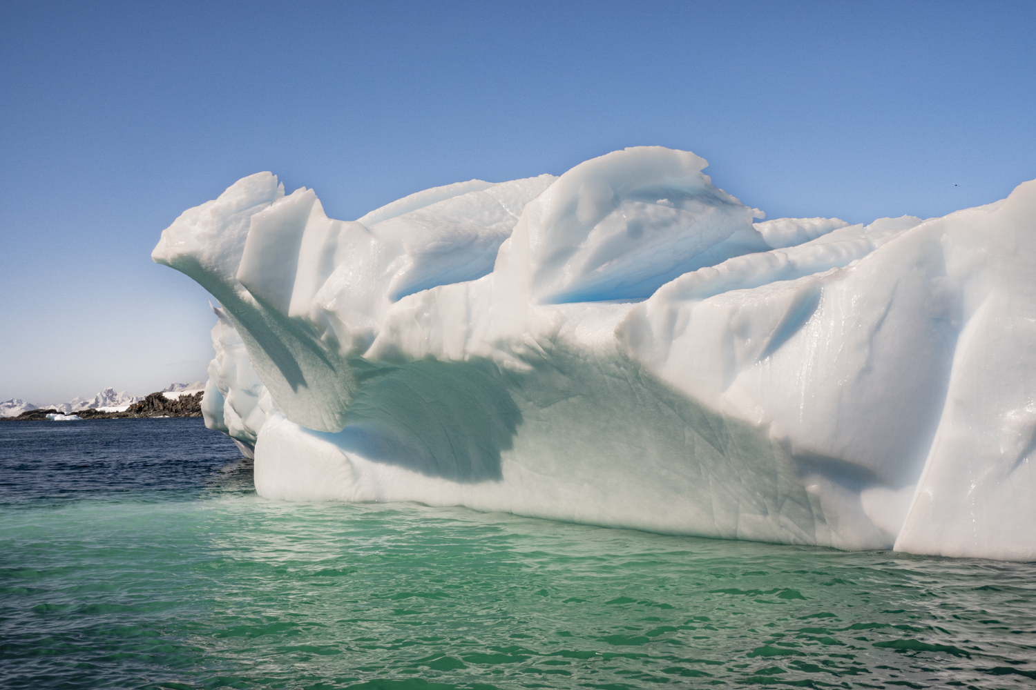
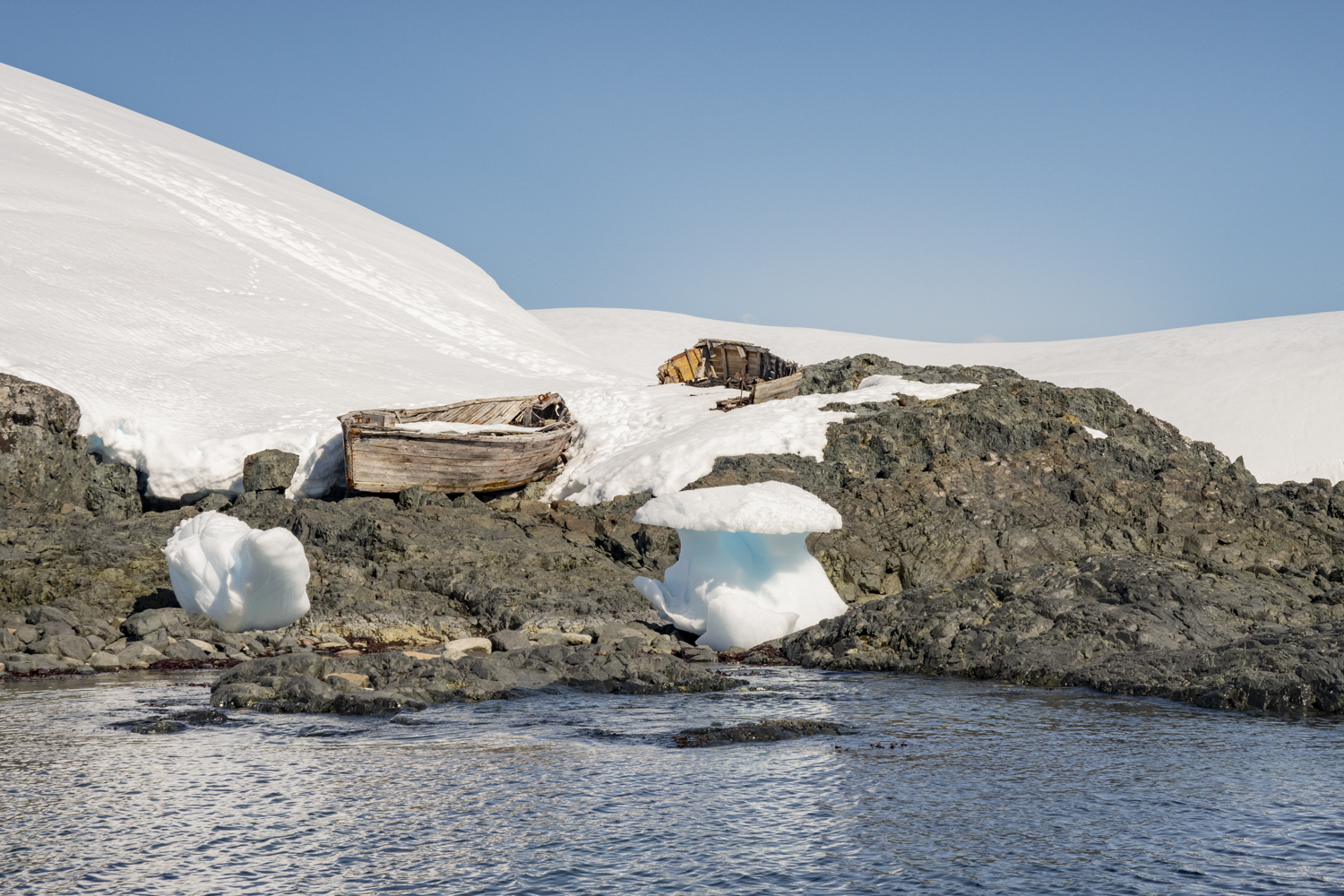
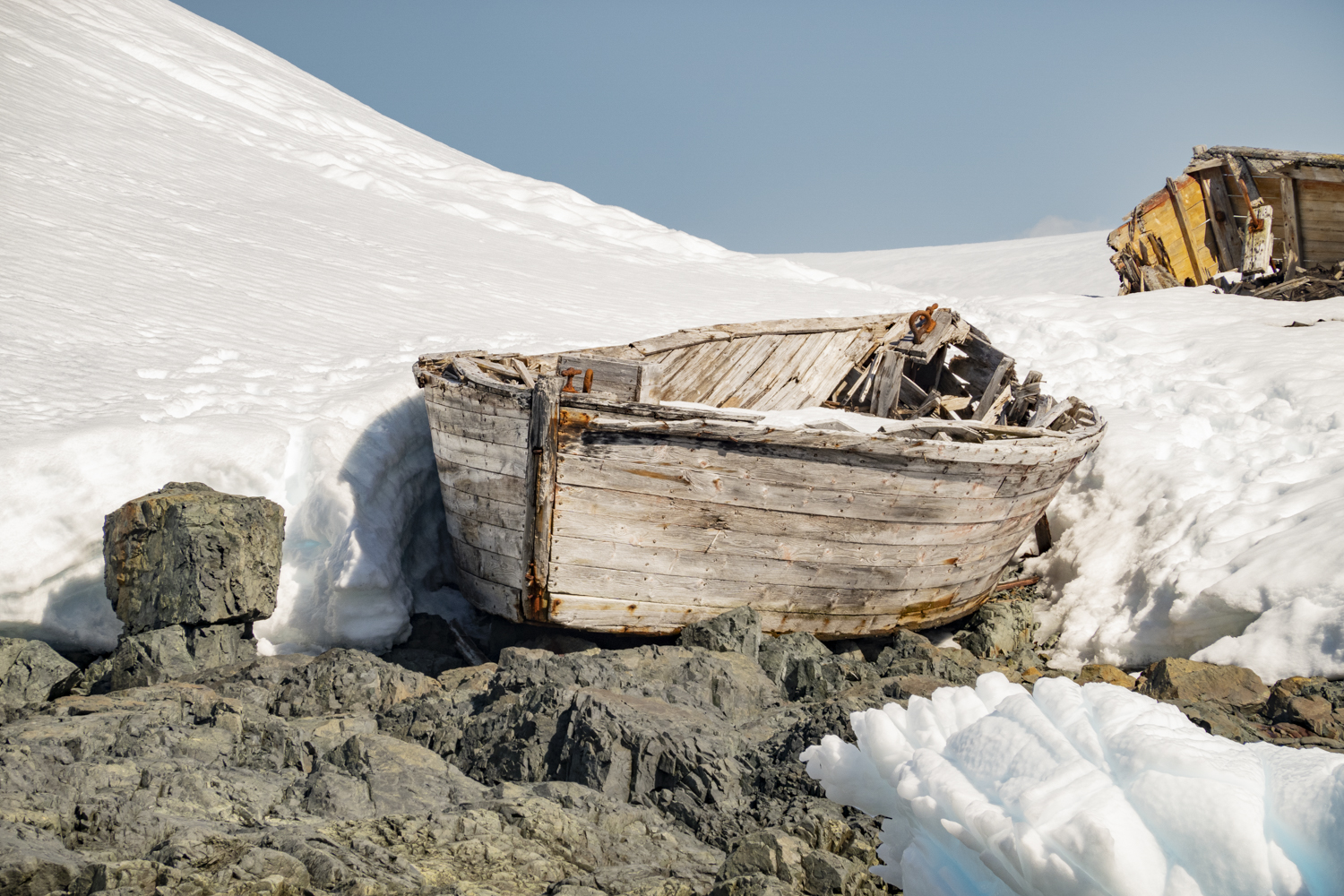
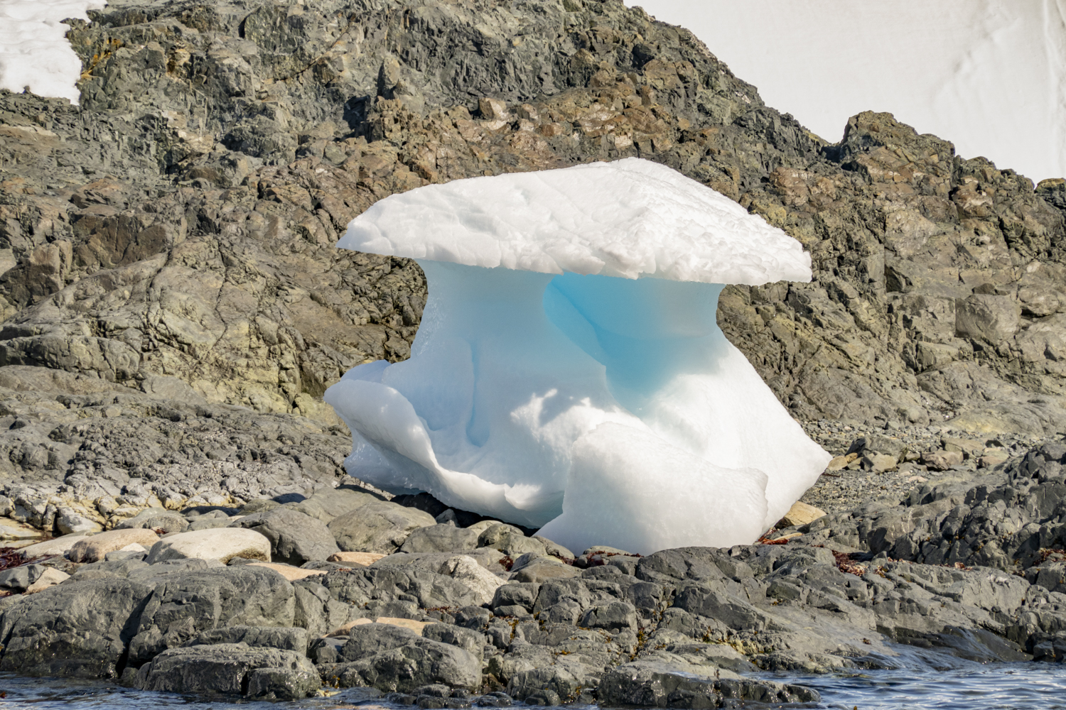
Enterprise Island, Antarctic Peninsula, Antarctica, photograph # 1 – an island in Wilhelmina Bay on the west side of Graham Land that was home to many whale oil processing ships in the early 1900s and has the wreck of the SS Guvernøren, a whale factory ship that caught fire in 1915 and was sunk in place to put out the fire in the hold; here was an unusually carved, corrugated iceberg
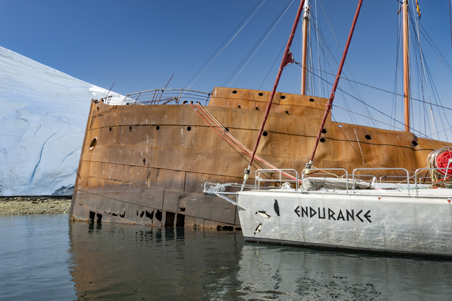
From Wilhelmina Bay we sailed mid-day to reach an anchorage off Enterprise Island. The island, 2.5 kilometers (1.6 miles) long, is located off the Danco coast of Graham Land in the north of the Antarctic Peninsula (in Wilhelmina Bay off the northern end of Nansen Island). Enterprise Island was charted during the Belgian Antarctic Expedition under Adrien de Gerlache in 1898, and the two islands – Elephant Island and Nansen Island – were charted together as one feature and named “Ile Nansen”. It was then known to whalers who operated in this region in the 1900s. whose enterprise led the United Kingdom Antarctic Place-names Committee to commemorate their enterprise with the eponymous name for the island. This area also features the wreck of the SS Guvernøren, a whale factory ship that caught fire in 1915. Today, the ship’s bow and bridge are above water, reclaimed by nature, and colonized by Antarctic Terns.
Enterprise Island, Antarctic Peninsula, Antarctica, photograph # 2 – another perspective of the unusually carved, corrugated icebergEnterprise Island, Antarctic Peninsula, Antarctica, photograph # 3Enterprise Island, Antarctic Peninsula, Antarctica, photograph # 4 — the wreck of the SS Guvernøren with two contemporary sailing yachts moored alongside after sailing to the Antarctic Peninsula from southern Argentina (one ship is from Argentina, the other is Russian)
“The GUVERNØREN was shipwrecked back in 1915 on January 27th after she caught on fire during a crew party, where the story goes that someone bumped a burning lantern off a table. A more comprehensive story is that the crew were celebrating a successful 1914-15 whaling season on the Antarctic peninsula with 5,050 cubic meters [178,339 cubic feet] of whale oil stored in her hull. Once she did catch fire all attempts to put the fire out failed, which included them firing explosive harpoons into the hull to partially sink her so that the ocean would put the fire out in order to save the cargo. However, all the cargo was lost BUT none of the 83 crew lost their lives, which is quite remarkable considering the remote area.” — https://steemit.com/history/@thomasjmitchell/guvernoren-shipwreck-at-enterprise-island
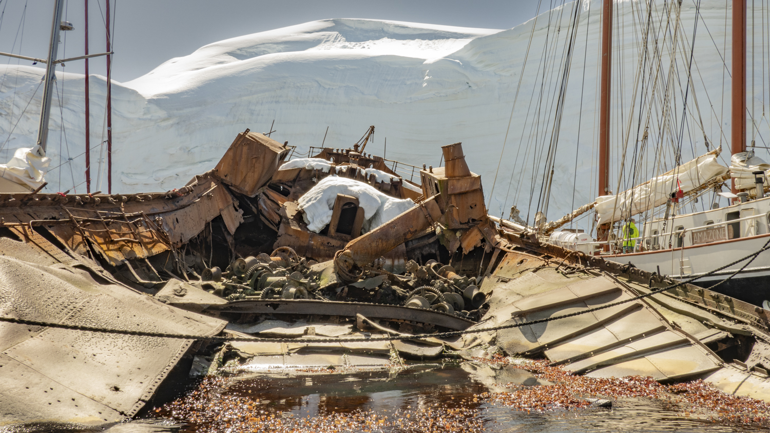
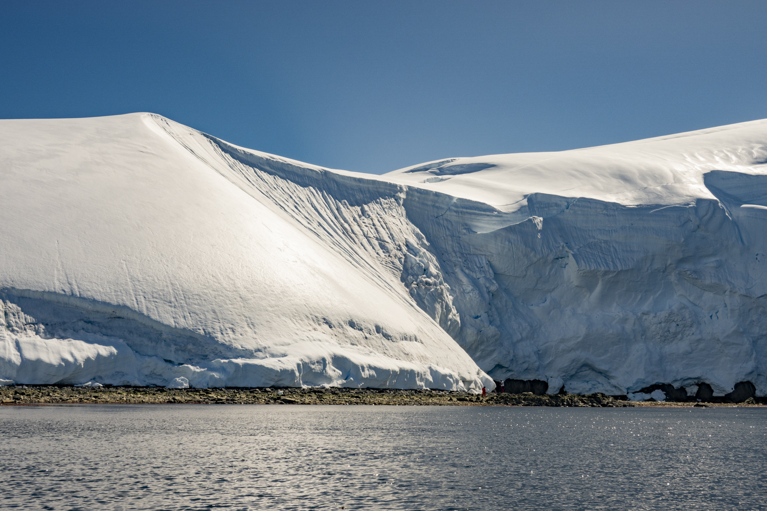
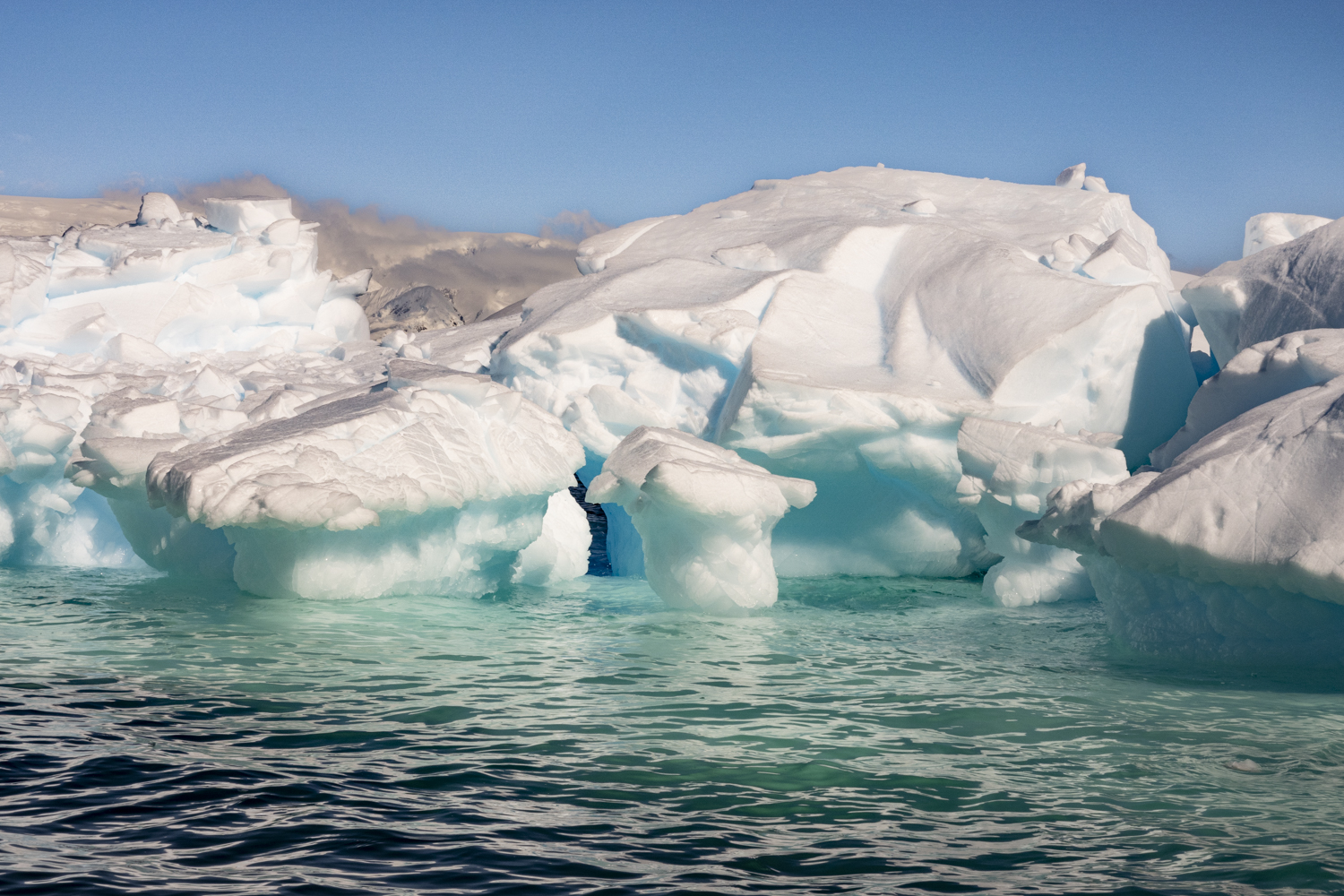
Enterprise Island, Antarctic Peninsula, Antarctica, photograph # 5Enterprise Island, Antarctic Peninsula, Antarctica, photograph # 6 – much of the oil processing equipment remains in place on the foredeck of the partially sunken SS GuvernørenEnterprise Island, Antarctic Peninsula, Antarctica, photograph # 7Enterprise Island, Antarctic Peninsula, Antarctica, photograph # 8 – two water boats used to collect fresh water dripping off the icebergs for use in processing the whales on the whale oil factory shipsEnterprise Island, Antarctic Peninsula, Antarctica, photograph # 9 – a close up of the water boats used to collect fresh waterEnterprise Island, Antarctic Peninsula, Antarctica, photograph # 10 – a fresh mushroom near the water boatsEnterprise Island, Antarctic Peninsula, Antarctica, photograph # 11 – red colored sea kelp at the base of the island under a canopy of snowEnterprise Island, Antarctic Peninsula, Antarctica, photograph # 12 – many of the icebergs around the island showed heavy wave and weather erosionEnterprise Island, Antarctic Peninsula, Antarctica, photograph # 13 – a stunning cornice, a reminder to downhill skiers of what we are missing sitting in a Zodiac and absorbing the fabulous scenery
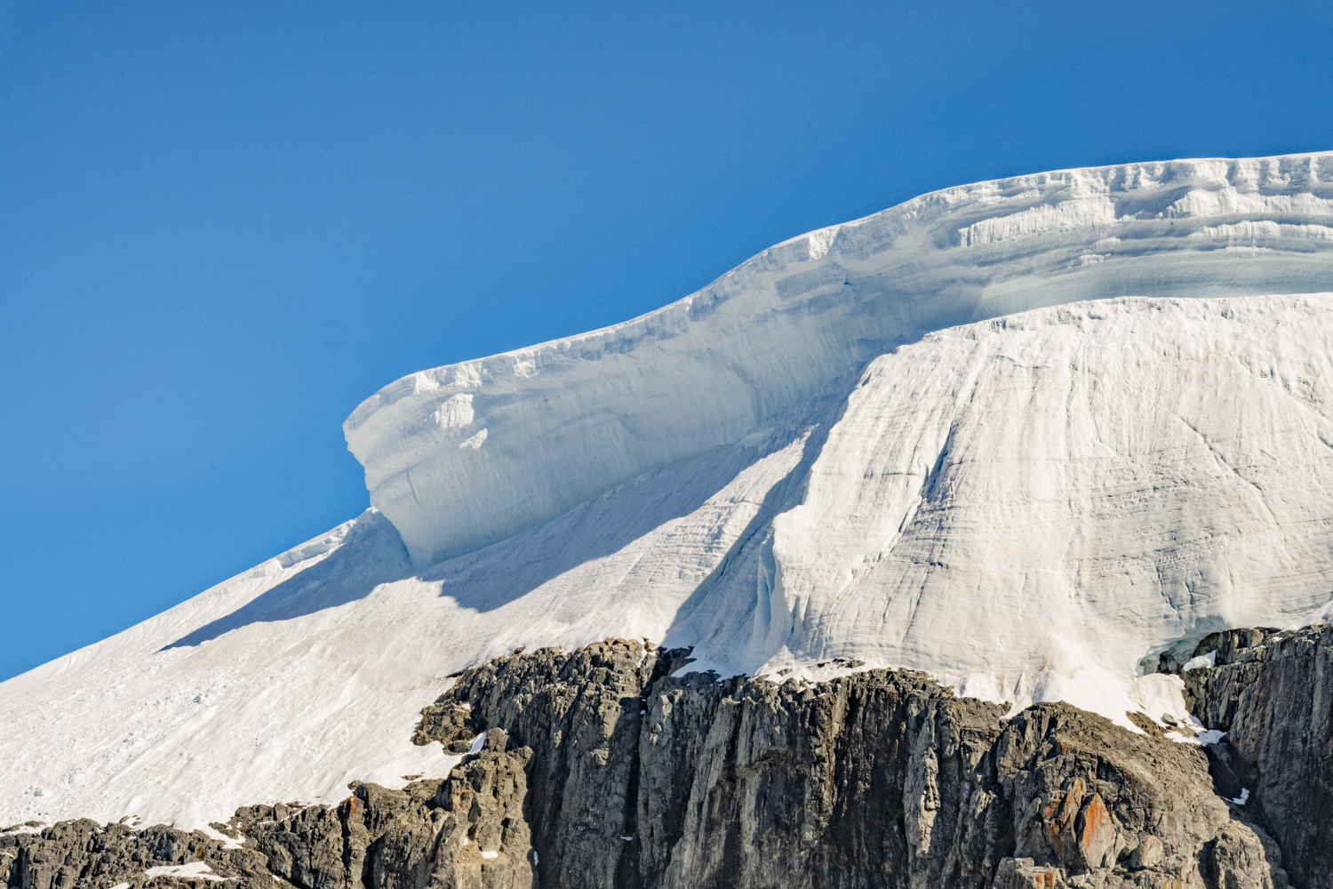
Red Rock Ridge, Antarctic Peninsula, Antarctica, photograph # 1 — a bay at the reddish-colored promontory eponymously named Red Rock Bluff on the Antarctic Peninsula, the furthest south point we landed at on this expedition, located at latitude 68°18′ South on the west coast of Graham Land
During lunch we sailed a little further south from Stonington Island to reach our furthest south point on this expedition, which was much further south than the ship’s prior two expeditions, going as far back as 2015 (we were also on that expedition).
“Red Rock Ridge or Morro Roca Roja or Promontorio Roca Roja is a conspicuous, reddish-colored ridge or promontory which rises to 690 meters [2,264 feet] and projects from the west coast of Graham Land between Neny Fjord and Rymill Bay. Red Rock Ridge is located at 68°18′ S 67°08′ W… Red Rock Ridge was surveyed in 1936 by the British Graham Land Expedition (BGLE) under John Riddoch Rymill, who so named it because of its color. Further surveys in 1948 by the Falkland Islands Dependencies Survey (FIDS) (FIDS) have identified this ridge as the feature first sighted in 1909 and named “Île Pavie” or “Cap Pavie” by the French Antarctic Expedition under Jean-Baptiste Charcot, but the name Red Rock Ridge is now too firmly established to alter.” – Wikipedia
A striking reddish-colored promontory, Red Rock Ridge is home to a large Adelie penguin colony. We encountered thousands of penguins while walking around the shore and uphill and saw many in the water from the Zodiac riding back to our ship.
Red Rock Ridge, Antarctic Peninsula, Antarctica, photograph # 2 — home to a large Adelie penguin colony, we encountered thousands of penguins while walking around the shore and uphill – here two are racing along the waterfront (on their bellies)Red Rock Ridge, Antarctic Peninsula, Antarctica, photograph # 3– two grey-colored chicks, several weeks old, with their mother in a colony, with other penguins looking onRed Rock Ridge, Antarctic Peninsula, Antarctica, photograph # 4 – Five Adelie penguins with a skua looking onRed Rock Ridge, Antarctic Peninsula, Antarctica, photograph # 5Red Rock Ridge, Antarctic Peninsula, Antarctica, photograph # 6Red Rock Ridge, Antarctic Peninsula, Antarctica, photograph # 7 – two grey-colored Adelie penguin chicks, several weeks old, with their motherRed Rock Ridge, Antarctic Peninsula, Antarctica, photograph # 8Red Rock Ridge, Antarctic Peninsula, Antarctica, photograph # 9Red Rock Ridge, Antarctic Peninsula, Antarctica, photograph # 10Red Rock Ridge, Antarctic Peninsula, Antarctica, photograph # 11
The Gullet, Antarctic Peninsula, Antarctica, photograph # 1 – sailing south toward the “entrance” to “the Gullet”, a narrow channel separating Adelaide Island with a peninsula-like protrusion of the Antarctic Peninsula (Graham Land) that is notorious for usually being choked by ice; we had hoped the channel would be passable (as a week’s worth of satellite images indicated), but, as seen here (and in that morning’s new satellite image), the Gullet was full of impassable pack ice
As we continued to sail further south along the west coast of the Antarctic Peninsula, the next morning we arrived at Detaille Island, a very scenic Island, just off the coast of the peninsula and east of the northern tip of the gigantic Adelaide Island. Detaille Island was first charted by Jean-Baptiste Charcot in 1909 and named for a principal of the Magellan Whaling Company. It was home to Base W of the British Antarctic Survey from 1956 to 1959, and the hut remains a time capsule of life on an Antarctic base. The island lies just below the Antarctic Circle and is also home to a small Adelie penguin colony. About 10 days prior, we had landed on a bright sunny day, so we are referring our readers to our blog post of that island landing and tour: https://richedwardsimagery.wordpress.com/2024/01/01/detaille-island-antarctic-peninsula-antarctica-2023/
After lunch we continued our southern course, heading south along the eastern coastline of Adelaide Island to reach “the Gullet”. The Gullet is a narrow channel separating Adelaide Island with a peninsula-like protrusion of the Antarctic Peninsula (Graham Land) that is notorious for usually being choked by ice. The region is surrounded by steep cliffs with many glaciers flowing into the ocean. The captain and our expedition team had been tracking satellite imagery of the region and ice reports and had hoped that on arrival we would find the channel navigable (without an ice breaker), as our ship has a reinforced double hull enabling us to traverse much ice without an icebreaker, such as our two complete transits of the Northwest Passage (in 2012 and 2019) without an icebreaker, becoming the only passenger ship in history to compete both a west-east and then an east-west transit of the Northwest Passage (assisted or unassisted).
Well, the weather had changed overnight, and the wind had blown the pack ice into a solid mass that was not navigable when we arrived. In order that we didn’t miss seeing this amazing phenomenon, the captain maneuvered the shop, bow forward, into the edge of the brash and pack ice in order that we might all go up on deck to see (and photograph) “the Gullet” choked with pack ice and icebergs. As you can see, the edge of the ice field is clearly delineated where the wind had pushed all the ice in the bay into the Gullet, blocking our passage. Going topside, we were able to walk around Deck 12 (the top deck) and enjoyed the phenomenon and made some nice images. Enjoy the Gullet!
The Gullet, Antarctic Peninsula, Antarctica, photograph # 2 – the edge of the pack ice is clearly visible here, showing the force of the weather in blowing all the pack ice together, making passage through the Gullet impassable that afternoonThe Gullet, Antarctic Peninsula, Antarctica, photograph # 3 – a panoramic photograph (10 separate images “stitched” together) of the ice in front of our ship and the surrounding steep cliffs with many glaciers flowing into the oceanThe Gullet, Antarctic Peninsula, Antarctica, photograph # 4The Gullet, Antarctic Peninsula, Antarctica, photograph # 5The Gullet, Antarctic Peninsula, Antarctica, photograph # 6The Gullet, Antarctic Peninsula, Antarctica, photograph # 7The Gullet, Antarctic Peninsula, Antarctica, photograph # 8 – there were many gigantic icebergs caught up with the pack ice, altogether blocking the channel (“the Gullet”)The Gullet, Antarctic Peninsula, Antarctica, photograph # 9The Gullet, Antarctic Peninsula, Antarctica, photograph # 10The Gullet, Antarctic Peninsula, Antarctica, photograph # 11 – the ship in the processing of turning around, to exit the area by heading north and then west to sail south around Adelaide Island to continue our journey further south (to Stonington Island the next morning); note the clear line at the edge of the pack iceThe Gullet, Antarctic Peninsula, Antarctica, photograph # 12 – temporarily heading north, with no pack ice in the way, but a few icebergs here and there
Detaille Island, Antarctic Peninsula, Antarctica, photograph # 1 – we went ashore on the southernmost point of our expedition to explore the nearly intact abandoned British research base constructed in 1956 for a team that spent 2 winters on the island before abandoning the site in 1959 when they had to walk across the peninsula to reach the supply ship that was unable to break through the summer ice to pick them up
Our furthest southern landing on this trip was at Detaille Island, the site of an abandoned – but nearly intact – British research base, reaching 66 degrees, 52 minutes 40 seconds South latitude, where we had a balmy 36 degrees Fahrenheit (2 degrees Celsius) temperature. The small island is located off the northern end of the Arrowsmith Peninsula in Graham Land on the Antarctic Peninsula. In addition to kayaking in the bay, wildlife spotted by members of the expedition included Crabeater seals, Adelie penguins and nesting Kelp gulls.
Detaille Island, Antarctic Peninsula, Antarctica, photograph # 2 – the main living hut of the abandoned British research base constructed in 1956
“From 1956 to 1959 it was home to “Base W” of the British Atlantic Survey and closed after the end of the International Geophysical Year (IGY). Detaille was a key monitoring site during the IGY. It is now often visited by Antarctic cruise [and expedition] ships but is otherwise unoccupied. Thanks to the men’s hasty departure and the necessity that they take little with them, Base W is an eerily preserved time capsule of 1950s Antarctic life. The base had been intended to host dog-sledging survey parties which would cross the sea ice to the nearby Antarctic Peninsula, but the ice was dangerously unstable. When Base W was vacated, heavy sea ice prevented resupply ship Biscoe from approaching closer than 50 kilometres (31 miles), despite the assistance of two U.S. icebreakers. So, the men were forced to close up the base, load sledges with only their most valuable gear and use dog teams to reach the ship.” – Wikipedia
Detaille Island, Antarctic Peninsula, Antarctica, photograph # 3 – the interior of the “Base W” research station of the British Atlantic Survey, abandoned in 1959, here a bunk room with hanging jacketsDetaille Island, Antarctic Peninsula, Antarctica, photograph # 4 — dozens of paint-size cans of Scotch oats in the “Base W” research station of the British Atlantic Survey, abandoned in 1959
“Detaille Island is a small island in the Lallemand Fjord, part of the Arrowsmith Peninsula in Graham Land. It’s not much more than a rocky outcrop with gravel beaches, but it contains one of the best-preserved historic monuments in the Antarctic.
“Detaille was home to “Base W” of the British Antarctic Survey. It was constructed in 1956 and was in use until 1959 when it was closed. Due to bad weather, the supply ship that was sent to take the men and equipment off the island couldn’t get any closer than 30 miles away. This meant that the men had to leave very quickly and with only the personal belongings that they could carry so the ship could depart as quickly as possible.
“Because of these circumstances, Base W is almost completely intact. As you look around the hut you will be greeted with the eerie sight of tables still set out with condiments, shelves stacked with tin and jars, and everyday equipment like washing machines, tools, and even and bottles of gin and whisky (empty!). Long johns and coats are half discarded, with magazines open on the tables, as they were left when the base was abandoned!
“Preserved by the United Kingdom Antarctic Heritage Trust, this is a remarkable insight into the early post-war scientific explorations of this amazing continent, and it makes Detaille Island and Base W a “must-visit” on any Antarctic itinerary… It was subsequently reoccupied for six months in 1965/66. During its short history as an occupied base, it contributed towards the geophysical programme of the International Geophysical Year (IGY). In addition to the base building, there are also dog kennels, an emergency store, fuel drum and cargo depots, an anemometer tower and wireless masts.” — www.polartours.com/highlights/detaille-island
Detaille Island, Antarctic Peninsula, Antarctica, photograph # 5 — the interior of the “Base W” research station of the British Atlantic Survey, abandoned in 1959, here another bunk room with hanging long johnsDetaille Island, Antarctic Peninsula, Antarctica, photograph # 6 — radio communication equipment in the “Base W” research station of the British Atlantic Survey, abandoned in 1959Detaille Island, Antarctic Peninsula, Antarctica, photograph # 7 – the view from outside the “Base W” research station living hut of the British Atlantic SurveyDetaille Island, Antarctic Peninsula, Antarctica, photograph # 8 – the Intrepid Explorer and your blogger at the overlook by the Base W” research station living hut of the British Atlantic SurveyDetaille Island, Antarctic Peninsula, Antarctica, photograph # 9 – a gull with some abandoned barrels near an outbuilding that was part of the “Base W” research station of the British Atlantic Survey, abandoned in 1959Detaille Island, Antarctic Peninsula, Antarctica, photograph # 10 — a view from the islandDetaille Island, Antarctic Peninsula, Antarctica, photograph # 11 — another view from the island
Prospect Point, Antarctic Peninsula, Antarctica, photograph # 1 – this was one of our few landings on the Antarctic Peninsula on this expedition (usually a rare occurrence, as many of the landing spots in the northwest of the Peninsula are on islands)
After our Zodiac cruising amongst the icebergs and jade ice in the bay around the Fish Islands, we cruised back to reboard the ship and then enjoyed some hot chocolate in the Plaza (reception/bar area) before lunch, while our team was hoisting the Zodiacs on board to the surface of the front of Deck 7, where they are stored while sailing. Over lunch the ship sailed just a short distance, to reposition us for Zodiac rides to the landing spot at Prospect Point, where we had a rare chance to get ashore on the mainland of the Antarctic Peninsula.
Prospect Point, Antarctic Peninsula, Antarctica, photograph # 2 — kayaking in the bay by Prospect Point
Prospect Point, Antarctic Peninsula, Antarctica, photograph # 3Prospect Point, Antarctic Peninsula, Antarctica, photograph # 4
“Prospect Point is a headland at the west extremity of Velingrad Peninsula on Graham Coast in Graham Land, four kilometers [2.4 miles] south of Ferin Head and immediately east of the Fish Islands. [The area was] roughly charted by the British Graham Land Expedition under Rymill, 1934–37. The name was suggested in 1957 by E. P. Arrowsmith, Governor of the Falkland Islands.
“Prospect Point was the location of the British research Station J. The hut, known as Penola, was occupied from February 2, 1957 to February 23, 1959 and the researchers carried out searching in the survey and geology. The station was removed in April 2004.” — Wikipedia
Prospect Point, Antarctic Peninsula, Antarctica, photograph # 5Prospect Point, Antarctic Peninsula, Antarctica, photograph # 6Prospect Point, Antarctic Peninsula, Antarctica, photograph # 7 – a lone penguin at the edge of the shore trying to decide if it’s meal time (which means jumping into the ocean to go “fishing”)Prospect Point, Antarctic Peninsula, Antarctica, photograph # 8 – the remains of the British research hut, “Station J”, actively used from 1957 through 1959
Signage at the site of the former British research hut, “Station J”:
PROSPECT POINT, Ferin Head, Graham Coast (66 degrees 00 minutes South, 65 degrees 21 minutes West)
On this site stood British Base J – Prospect Point.
The base was built by the Falkland Islands Dependencies Survey in February 1957 and was occupied until February 1959. The principal scientific research carried out there was topographic survey and geology. Following a conservation survey of all Britain’s disused bases in the Antarctic Peninsula in March 1994, this base was not selected as an historic site under the Antarctic Treaty. It was demolished and removed in April 2004 by the British Antarctic Survey with assistance from AWG Construction Services Ltd to comply with the Environmental Protocol to the Antarctic Treaty.
Prospect Point, Antarctic Peninsula, Antarctica, photograph # 9Prospect Point, Antarctic Peninsula, Antarctica, photograph # 10Prospect Point, Antarctic Peninsula, Antarctica, photograph # 11
Fish Islands, Antarctic Peninsula, Antarctica, photograph # 1 – discovered less than 100 years ago, this small cluster of islands are found just north of the Antarctic Circle (latitude 66 degrees 33.3 minutes South), off the Graham Coast of Graham Land on the Antarctic Peninsula
Home to breeding Adelie penguins and Blue-eyed shags, the Fish Islands were first charted by John Rymill’s British Graham Land Expedition of 1934-37. This small cluster of islands are found just north of the Antarctic Circle (latitude 66 degrees 33.3 minutes South), off the Graham Coast of Graham Land on the Antarctic Peninsula. There are fantastic icebergs all around the islands.
We enjoyed a Zodiac cruise in the bay, relishing the arrival of a sunny day. Our driver/naturalist found some “jade” ice [a new discovery for many of us], along with beautiful icebergs and icicles as we cruised the bay.
Fish Islands, Antarctic Peninsula, Antarctica, photograph # 2Fish Islands, Antarctic Peninsula, Antarctica, photograph # 3 — there are fantastic icebergs all around the islandsFish Islands, Antarctic Peninsula, Antarctica, photograph # 4Fish Islands, Antarctic Peninsula, Antarctica, photograph # 5Fish Islands, Antarctic Peninsula, Antarctica, photograph # 6 – note the small dark ice with “scales” – that is “jade ice” or a jade icebergFish Islands, Antarctic Peninsula, Antarctica, photograph # 7 – a close up of the jade iceberg
“Jade icebergs are formed under very different conditions, when mineral-rich seawater freezes to the underside of an ice shelf in layers, then eventually breaks off and floats away. These jade bergs contain layers of the pure blue-white ice from the glacier and greener ice below, formed from frozen seawater.” — www.antarctica.gov.au/news/2019/new-clues-in-jade-iceberg-mystery/
[Editor’s note: “south” was substituted for “north” for this poem to be
relevant to Antarctica, rather than the northern latitudes…]
Little Lady Icicle is dreaming in the south-land And gleaming in the south-land, her pillow all a-glow; For the frost has come and found her With an ermine robe around her Where little Lady Icicle lies dreaming in the snow.
Little Lady Icicle is waking in the south-land, And shaking in the south-land her pillow to and fro; And the hurricane a-skirling Sends the feathers all a-whirling Where little Lady Icicle is waking in the snow.
Little Lady Icicle is laughing in the south-land, And quaffing in the south-land d her wines that overflow; All the lakes and rivers crusting That her finger-tips are dusting, Where little Lady Icicle is laughing in the snow.
Little Lady Icicle is singing in the south-land, And bringing from the south-land a music wild and low; And the fairies watch and listen Where her silver slippers glisten, As little Lady Icicle goes singing through the snow.
Little Lady Icicle is coming from the south-land, Benumbing all the south-land where’er her feet may go; With a fringe of frost before her And a crystal garment o’er her, Little Lady Icicle is coming with the snow.