Grise Fiord, Ellesmere Island, Nunavut, Canada

Grise Fiord, Ellesmere Island, Nunavut, Canada, photograph # 1 – the town is situated in a spectacular landscape, nestled beneath tall cliffs at the entrance to a beautiful fiord in the southern shores of Ellesmere Island at Jones Sound

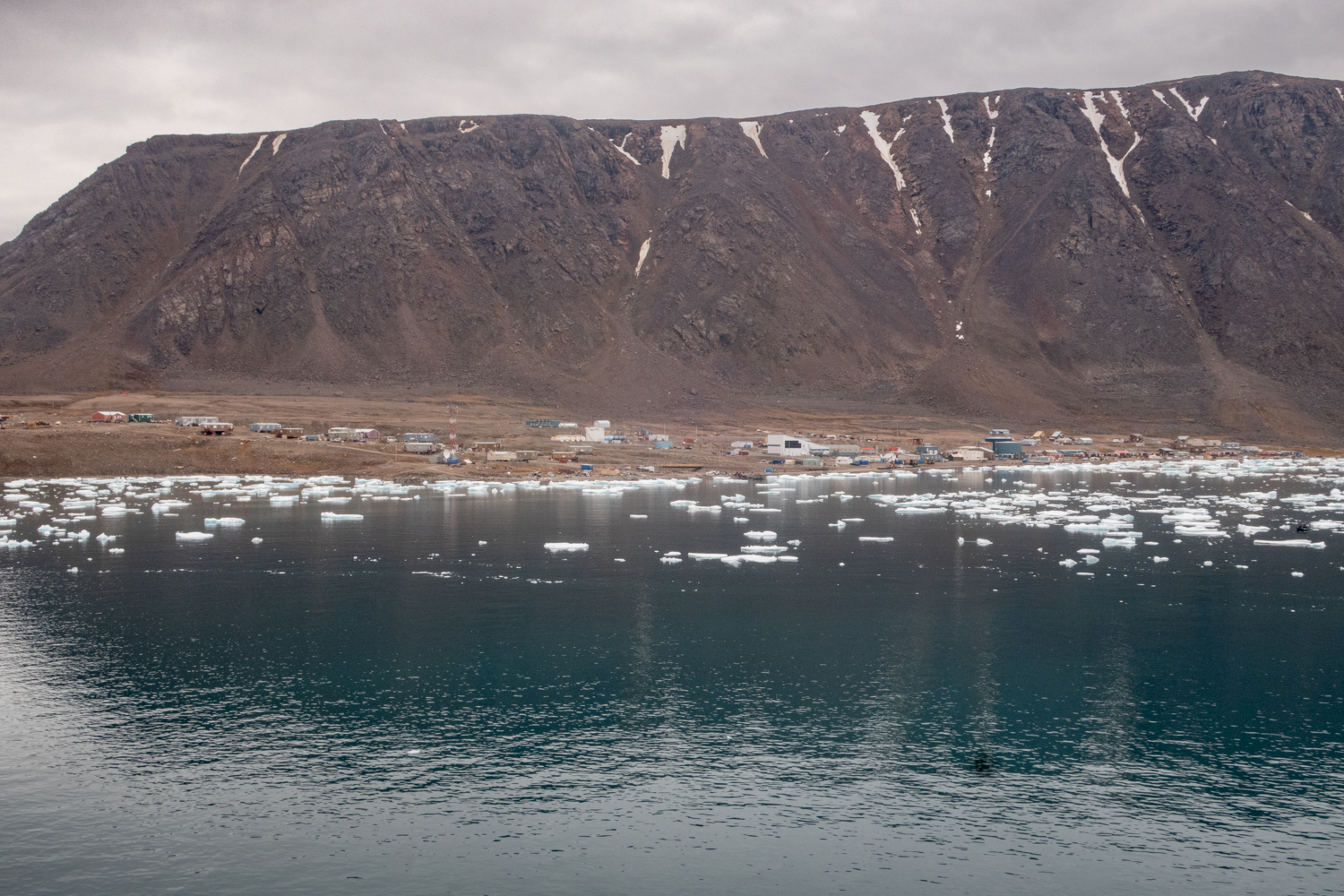
From our anchorage at South Cape Fiord, we sailed about 50 miles (80 kilometers) east to Grise Fiord on the southeast corner of Ellesmere Island.  The town looks across a body of water called Jones Sound to the south, toward Devon Island.   “Grise Fiord is situated in a spectacular landscape, nestled beneath tall cliffs at the entrance to a beautiful fiord in the southern shores of Ellesmere Island at Jones Sound… Known as ‘Aujuittuq’ in Inuktitut [meaning “place that never thaws”] this warmly hospitable little hamlet is the northernmost community in Nunavut and Canada.  Due to its remote and isolated location near the top of the world, it is a tightly knit community.  The airstrip is short, so only medium sized aircrafts can land here, but when visitors arrive, they are always welcomed with big smiles.  The word ‘Grise’ is Norwegian for ‘pig.’ There are no swine here, never were, but the Norwegian explorer Otto Sverdrup named this place ‘pig fiord’ [or, “pig inlet”] in 1899 because the loud sounds of walrus herds gathered here reminded him of grunting pigs. The Inuktitut name is more appropriate. It never completely thaws out, even when the sun shines constantly 24 hours a day from April through August.” — https://travelnunavut.ca/regions-of-nunavut/communities/grise-fiord/

The population of Grise Fiord is 143, of which 95% are Inuit.  Ancestors of the Inuit, including Paleo-Eskimo, Pre-Dorset, Dorset and Thule peoples all lived in southern Ellesmere Island.  Because of the harsh weather and lack of resources, the local Inuit abandoned the region around Grise Fiord sometime before 1700 A.D.  “The modern Inuit community of Grise Fiord did not exist until 1953 when the Government of Canada forcibly relocated Inuit families here from their Nunavik home of Inukjuak in northern Québec.  The High Arctic Relocation Program also happened to the Inuit people of present-day Resolute.  The federal government formally apologized to the Inuit people for this harsh treatment in 2008.  The transition was arduous because the climate is far more severe than northern Québec and the game animals are different.  Fortunately, the Inuit people of Grise Fiord are excellent hunters, gifted seamstresses and resourceful, good-natured providers for their families.” — https://travelnunavut.ca/regions-of-nunavut/communities/grise-fiord/

Grise Fiord is one of only three populated places on Ellesmere Island.  The town lies 1,160 kilometers (720 miles) north of the Arctic Circle, and is the northernmost civilian community in Canada.  Wikipedia notes that “it is also one of the coldest inhabited places in the world, with an average yearly temperature of −16.5 °C (2.3 °F).”  On our visit, towards the end of August, the temperature in the morning was close to freezing (32 degrees Fahrenheit or 0 degrees Centigrade).

Grise Fiord, Ellesmere Island, Nunavut, Canada, photograph # 2 – winter sleds take a “rest” during the summer after the snow melts; with plastic runners, these sleds are now pulled by snowmobiles (skidoos) for transport of people and equipment

The settlement of Grise Fiord is an extremely sad story of government geopolitical ambitions executed at an extremely high human cost.  Before sailing into the bay at Grise Fiord, our expedition leader, a former policeman and ship captain in the RCMP (Royal Canadian Mounted Police), now retired and an experienced Northwest Passage and Canadian Arctic ship captain, told us the history of the town.  It is a story that is still NOT taught in Canadian schools and only understood by the Nunavut locals and explorers (and some visitors) to the northern area of Nunavut.

“This community (and that of Resolute) was created by the Canadian government in 1953, partly to asset sovereignty in the High Arctic during the Cold War.  Eight Inuit families from Inukjuak, Quebec (on the Ungava Peninsula), were relocated after being promised homes and game to hunt, but the relocated people discovered no buildings and very little familiar wildlife.  They were told that they would be returned home after a year if they wished, but this offer was later withdrawn, for it would have damaged Canada’s claims to sovereignty in the area; the Inuit were forced to stay.  Eventually, the Inuit learned the local beluga whale migration routes and were able to survive in the area, hunting over a range of 18,000 square kilometers (6,900 square miles) each year.” – Wikipedia

“The community of Grise Fiord was created in 1953 when the Canadian government relocated 3 families from Port Harrison (now Inukjuak), Quebec. They were accompanied by one family from Pond Inlet who were to ease their adjustment to life in the High Arctic.” — http://toolkit.buildingnunavut.com/en/community/load/B17AC5F3-8273-41EC-9982-A1F700F2D229

In 1993, the Canadian government held hearings to investigate the relocation program. The Royal Commission on Aboriginal Peoples issued a report entitled The High Arctic Relocation: A Report on the 1953–55 Relocation, recommending a settlement.  The government paid 10 million Canadian dollars to the survivors and their families and gave a formal apology in 2010.

Grise Fiord, Ellesmere Island, Nunavut, Canada, photograph # 3 — a small neighborhood of homes that show the construction technique used in the Far North — the houses are wooden and built on platforms to cope with the freezing and thawing of the permafrost

Grise Fiord, Ellesmere Island, Nunavut, Canada, photograph # 4 – three homes share one building – note the separate wooden ramp/stairs entrances and the platform the house sits on

“The houses are wooden and built on platforms to cope with the freezing and thawing of the permafrost.  Hunting is still an important part of the lifestyle of the mostly Inuit population. Quota systems allow the villagers to supply many of their needs from populations of seals, walruses, narwhal and beluga whales, polar bears and muskox.Wikipedia

Grise Fiord, Ellesmere Island, Nunavut, Canada, photograph # 5 – a stream running downhill through the town with a bunch of wild Arctic cotton growing on both sides

Grise Fiord, Ellesmere Island, Nunavut, Canada, photograph # 6 – a sign on the upslope road to the local airport, one of two transportation modes to reach the town – the other is by water, the historical “pathway” for the ancient Thules and visiting Greenlanders, and today’s Inuit

Grise Fiord, Ellesmere Island, Nunavut, Canada, photograph # 7 — our small group walking tour of Grise Fiord was led by one of the town’s elders, Larry Audlaluk; when we got to the “monument of the first Inuit settlers of 1953 and 1955 in Grise Fiord” by Looty Pijamini (and the explanatory plaque) – see photographs # 8 and 9, below – he sat down and told us a little of his and his family’s personal story of the settlement, dating back to when they arrived and he was a 3-year old toddler

Larry Audlaluk was a 3-year-old toddler when he and his family (including 6 older siblings) were relocated by the Canadian government from Inukjuak on Hudson Bay, Canada, to Grise Fiord in 1953; his father died 10 months later.  Larry’s life story, What I Remember, What I Know: The Life of a High Arctic Exile (2020), provides a detailed personal account of the danger and death that they faced.  His parting words to us at the monument were a wonderful sentiment, “after you leave Grise Fiord, please wake up each day and enjoy the sunlight and think of me.”  (Note that Grise Fiord, way above the Arctic Circle at N 76º 25′ W 82º 54′, has no sunlight for half the year.)

“The High Arctic relocation is the subject of Zacharias Kunuk’s film Exile.  The film was produced by Isuma, who also released Atanarjuat: The Fast Runner, the first feature film ever to be written, directed and acted entirely in Inuktitut.  The High Arctic relocation is the subject of the film Broken Promises – The High Arctic Relocation by Patricia Tassinari (NFB, 1995). The relocation is also the subject of Marquise Lepage’s documentary film (NFB, 2008), Martha of the North (Martha qui vient du froid).  This film tells the story of Martha Flaherty, granddaughter of Robert J. Flaherty, who was relocated at 5, along with her family, from Inukjuak to Grise Fiord (Ellesmere Island).” — Wikipedia

Grise Fiord, Ellesmere Island, Nunavut, Canada, photograph # 8 – the dedication plaque for the monument to commemorate the Inuit settlers of 1953 and 1955

Grise Fiord, Ellesmere Island, Nunavut, Canada, photograph # 9 – a monument to commemorate the Inuit who sacrificed so much as a result of the Government’s forced relocation program of 1953 and 1955; the statue was carved on site by artist and Grise Fiord resident Looty Pijamini, and an assistant, in 2009

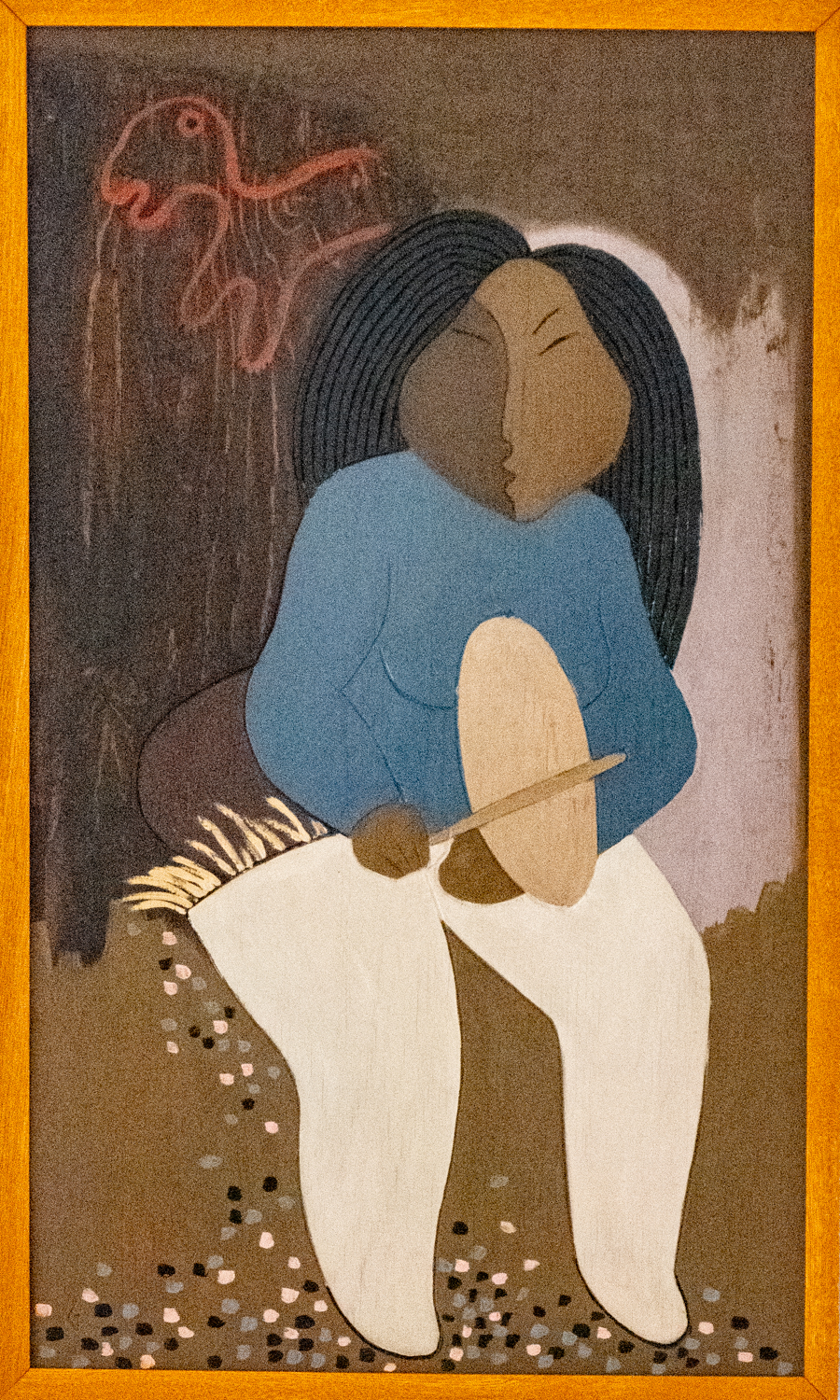
“In 2009, artist and Grise Fiord resident Looty Pijamini was commissioned by Nunavut Tunngavik Incorporated to build a monument to commemorate the Inuit who sacrificed so much as a result of the Government’s forced relocation programme of 1953 and 1955.  Pijamini’s monument, located in Grise Fiord, depicts a woman with a young boy and a husky, with the woman somberly looking out towards Resolute Bay.  Amagoalik’s monument, located in Resolute, depicts a lone man looking towards Grise Fiord.  This was meant to show separated families, and depicting them longing to see each other again.” – Wikipedia

Grise Fiord, Ellesmere Island, Nunavut, Canada, photograph # 10 – our visit coincided with the annual visit of the “sealift” ship that is packed in Quebec, Canada, and delivers food, fuel, vehicles, construction materials, etc. that have to last a year

Grise Fiord, Ellesmere Island, Nunavut, Canada, photograph # 11 – “reflection”

Grise Fiord, Ellesmere Island, Nunavut, Canada, photograph # 12 – it was a challenge for the crew of the “sealift” ship to unload its cargo for the town through the icebergs (note that the ship has cargo for multiple towns onboard, so only a portion was offloaded in Grise Fiord)

Grise Fiord, Ellesmere Island, Nunavut, Canada, photograph # 13 – the icebergs bunch up on the shore, making beach landings a challenge

Grise Fiord, Ellesmere Island, Nunavut, Canada, photograph # 14 – one of 4 trucks delivered this week – this one has a funny story, noted below

Looking at the photograph, one asks, “why are all those guys climbing all over the truck and looking in?” (it’s the same question we asked from ashore).  The purchaser didn’t think it was a funny story, but the townspeople and we did.  Apparently, when the truck was loaded onto the barge, someone, somehow, (accidentally) locked the keys in the truck.  So, until they figured out how to open the truck, it wasn’t going anywhere.  Note that the purchaser, one of the men in town, bought it as a present for his dad.

Grise Fiord, Ellesmere Island, Nunavut, Canada, photograph # 15 — small boats are used in summer to reach hunting grounds, or hunting sea mammals on the ocean; the day before our visit many men were out in the ocean hunting narwhal whales

Grise Fiord, Ellesmere Island, Nunavut, Canada, photograph # 16 – two fishermen heading out through the icebergs; in the background (left) is the local airport, beyond homes on the edge of the town

Grise Fiord, Ellesmere Island, Nunavut, Canada, photograph # 17 – our Zodiacs had to carefully zig-zag through the icebergs to go back and forth between the ship at anchor and the beach landing site (reached through a break in the icebergs)

Wikipedia has a more extensive article on the “High Artic relocation” of 92 Inuit from northern Quebec Province to Ellesmere Island to serve as “human flagpoles” to help Canada assert its sovereignty in the Far North during the Cold War (1953-1955), https://en.wikipedia.org/wiki/High_Arctic_relocation

“The High Arctic relocation (French: La délocalisation du Haut-Arctique, Inuktitut: ᖁᑦᑎᒃᑐᒥᐅᑦᑕ ᓅᑕᐅᓂᖏᑦ, romanized: Quttiktumut nuutauningit ) took place during the Cold War in the 1950s, when 92 Inuit  were moved by the Government of Canada under Liberal Prime Minister Louis St. Laurnet to the High Arctic.

“The relocation has been a source of controversy: on one hand being described as a humanitarian gesture to save the lives of starving indigenous people and enable them to continue a subsistence lifestyle; and on the other hand, said to be a forced migration instigated by the federal government to assert its sovereignty[in the Far North by the use of “human flagpoles”, in light of both the Cold War and the disputed territorial claims to the Canadian Arctic Archipelago.  Both sides acknowledge that the relocated Inuit were not given sufficient support to prevent extreme privation during their first years after the move.

“In August 1953, seven or eight families from Inukjuak, northern Quebec (then known as Port Harrison) were transported to Grise Fiord on the southern tip of Ellesmere Island and to Resolute of Cornwallis Island. The group included the family of writer Markoosie Patsaug.  The families, who had been receiving welfare payments, were promised better living and hunting opportunities in new communities in the High Arctic.  They were joined by three families recruited from the more northern community of Pond Inlet (in the then Northwest Territories, now part of Nunavut), whose purpose was to teach the Inukjuak Inuit skills for survival in the High Arctic.  The methods of recruitment and the reasons for the relocations have been disputed. The government stated that volunteer families had agreed to participate in a program to reduce areas of perceived overpopulation and poor hunting in Northern Quebec, to reduce their dependency on welfare, and to resume a subsistence lifestyle.  In contrast, the Inuit reported that the relocations were forced and were motivated by a desire to reinforce Canadian sovereignty in the Canadian Arctic Archipelago by creating settlements in the area.  The Inuit were taken on the Eastern Arctic patrol ship  CGS C.D. Howe to areas on Cornwallis and Ellesmere Islands (Resolute and Grise Fiord), both large barren islands in the hostile polar north.  While on the boat the families learned that they would not be living together but would be left at three separate locations.

“In Relocation to the High Arctic, Alan R. Marcus proposes that the relocation of the Inuit not only served as an experiment, but as an answer to the Eskimo problem.   The federal government stressed that the Eskimo problem was linked to the Inuit’s reluctance to give up their nomadic ways in areas that were supposedly overpopulated and went so far as to provide detailed accounts of poor hunting seasons and starvation within the Inukjuak area as a direct result of over-population. However, the federal government knew the area in question was in the midst of a low trapping season due to the end of a four-year fox cycle.

“The families were left without sufficient supplies of food and caribou skins and other materials for making appropriate clothing and tents.  As they had been moved about 2,000 km (1,200 mi) to a very different ecosystem, they were unfamiliar with the wildlife and had to adjust to months of 24-hour darkness during the winter, and 24-hour sunlight during the summer, something that does not occur in northern Quebec. They were told that they would be returned home after two years if they wished, but these promises were not honoured by the government.

“The relocatees included Inuit who had been involved in the filming of Robert J. Flaherty’s film Nanook of the North (1922) and Flaherty’s unacknowledged illegitimate son Josephie.  However, Flaherty had died in 1951, prior to the relocation.  Eventually, the Inuit learned the local beluga whate migration routes and were able to survive in the area, hunting over a range of 18,000 km2 (6,950 sq mi) each year.” — Wikipedia

The article concludes with a detailed discussion of the re-evaluation of the move.  In summary, in 1993, the Canadian government held hearings to investigate the relocation program.  The Royal Commission on Aboriginal Peoples issued a report entitled The High Arctic Relocation: A Report on the 1953–55 Relocation, recommending a settlement that was done in 2010, including an apology and the payment of 10 million Canadian dollars to the survivors and their families.

Legal Notices: All photographs copyright © 2023 by Richard C. Edwards.  All Rights Reserved Worldwide.  Permission to link to this blog post is granted for educational and non-commercial purposes only.

South Cape Fiord Icebergs, Ellesmere Island, Nunavut, Canada

South Cape Fiord Icebergs, Ellesmere Island, Nunavut, Canada, photograph # 1 – between ship and shore (and vice versa) we passed numerous “shapely” icebergs worthy of a “portrait”

As noted in our previous blog post, “https://richedwardsimagery.wordpress.com/2023/08/30/south-cape-fiord-ellesmere-island-nunavut-canada/”, South Cape Fiord is a major inlet about 50 miles (80 kilometers) west of Grise Fiord on the southeast corner of Ellesmere Island.  At the head of the Fiord, is a large tidewater glacier.  The fiord is full of icebergs in the summer and freezes over in the winter.  This blog post is a collection of some of the interesting iceberg shapes that we sailed past as we went back and forth from the ship to shore (for a wet landing and a nature hike).  Note that the blue tint in the icebergs is a natural phenomenon.  For further information on the blue tinting, please see our previous blog post, “https://richedwardsimagery.wordpress.com/2023/08/18/nuup-kangerlua-fjord-the-nuuk-fjord-greenland-2023/”.

South Cape Fiord Icebergs, Ellesmere Island, Nunavut, Canada, photograph # 2

South Cape Fiord Icebergs, Ellesmere Island, Nunavut, Canada, photograph # 3

South Cape Fiord Icebergs, Ellesmere Island, Nunavut, Canada, photograph # 4

South Cape Fiord Icebergs, Ellesmere Island, Nunavut, Canada, photograph # 5

South Cape Fiord Icebergs, Ellesmere Island, Nunavut, Canada, photograph # 6

South Cape Fiord Icebergs, Ellesmere Island, Nunavut, Canada, photograph # 7

South Cape Fiord Icebergs, Ellesmere Island, Nunavut, Canada, photograph # 8 – a panorama of our ship at anchor in the fiord surrounded by icebergs

Legal Notices: All photographs copyright © 2023 by Richard C. Edwards.  All Rights Reserved Worldwide.  Permission to link to this blog post is granted for educational and non-commercial purposes only.

South Cape Fiord, Ellesmere Island, Nunavut, Canada

South Cape Fiord, Ellesmere Island, Nunavut, Canada, photograph # 1 – our Zodiac wet landing spot was the beach to the right of the bottom of the glacier; we had the opportunity to hike along the shore and climb part way up the glacier for good views of the fjord

After leaving our anchorage at the end of the Feacham Bay area of Buchan Gulf., Baffin Island, Nunavut, Canada, we sailed north to Baffin Island’s largest town, Pond Inlet, located on the northeast corner of the island, across from the mountainous and glacier covered Bylot Island.  On our 2019 Northwest Passage Expedition we had two very pleasant days in Pond Inlet, particularly with visits among the native Inuit in several locales around town, particularly at the library/museum and the community center where we watched Inuit adults and children in several cultural performances.  [See our previous blog posts, “https://richedwardsimagery.wordpress.com/2019/09/02/pond-inlet-baffin-island-nunavut-canada/” and “https://richedwardsimagery.wordpress.com/2019/09/03/helicopter-flight-above-pond-inlet-baffin-island-nunavut-canada/”.]

Mother Nature had other ideas for us on this expedition.  As we sailed into our anchorage just off the shore of Pond Inlet, a large storm made Zodiac landings all but impossible – winds over 50 knots and very rough sea conditions (waves and swells over 5 meters (16 feet).  All touring shore landings were canceled, so we did not have the opportunity to visit the community that had welcomed us warmly in 2019.  (We were able to get some recently shipped in supplies – mainly fresh food items – loaded onto Zodiacs, and several Zodiacs successfully ferried disembarking passengers to shore and returned with some freshly embarking passengers to the ship, thanks to some really outstanding Zodiac handling by our highly trained and experienced crew and expedition Zodiac drivers.)

The storm in Baffin Bay intensified overnight, so we stayed at anchor in the protected channel between Pond Inlet and Bylot Island until 5:30 a.m. the next day, when the captain saw that the worst of the storm had passed (to the north) and we sailed out of the channel into Baffin Bay to sail north (behind the storm) in rough seas to our next destination, the most northern island of Nunavut (Canada), Ellesmere Island.  We sailed past the largest settlement on Ellesmere Island, Grise Fiord, with a population of about 144 (almost all Inuit), the northernmost town in all of Canada.  After sailing through the first pack ice we have encountered on this expedition, we reached out destination on Ellesmere Island, South Cape Fiord in a bay filled with icebergs.

South Cape Fiord, Ellesmere Island, Nunavut, Canada, photograph # 2 – in addition to hiking ashore, there were a number of two-person kayaks out for a two-hour paddle around the bay; our ship is anchored in the background

South Cape Fiord is a major inlet about 50 miles (80 kilometers) west of Grise Fiord on the southeast corner of Ellesmere Island.  At the head of the Fiord, is a large tidewater glacier.  The area offers exceptional cruising and kayaking opportunities, and some excellent hiking locations.  The hills above the inlet are a prime location for sharp-eyed travelers to spot resident muskox, which were not spotted on our short afternoon visit.

South Cape Fiord, Ellesmere Island, Nunavut, Canada, photograph # 3 – two of the ship’s Zodiacs idling in the bay before picking up passengers from the shore landing to return to the ship; note how the wind has blown many smaller ice floes and icebergs against the shoreline

South Cape Fiord, Ellesmere Island, Nunavut, Canada, photograph # 4 – a small Arctic nodding campion (silene uralensis) plant with purple flowers; note that the bell shape invites small insects inside where the flower can then trap them; other names for the plant include polar campion, cockle, mountain campion, apetalous catchfly, mountain catchfly, and nodding catchfly — while it does attract pollinators like bees and butterflies, it does not (as some of its names suggest) catch flies

South Cape Fiord, Ellesmere Island, Nunavut, Canada, photograph # 5 – snow (or Alpine) saxifrage (saxifrage nivalis), a perennial plant that is one of the most common Arctic plants, also seen with bright yellow-colored flowers (saxifrage hirculus)

South Cape Fiord, Ellesmere Island, Nunavut, Canada, photograph # 6 – Arctic fox teeth found among the moraine stones on the beach

South Cape Fiord, Ellesmere Island, Nunavut, Canada, photograph # 7 — along the beach we found many Arctic willow plants growing on dirt mounds in the midst of the moraine stones on the beach

South Cape Fiord, Ellesmere Island, Nunavut, Canada, photograph # 8 – our naturalists were surprised to find this old whale bone so far from the beach, near the bottom of the glacier

South Cape Fiord, Ellesmere Island, Nunavut, Canada, photograph # 9 – a close-up of the whale bone

South Cape Fiord, Ellesmere Island, Nunavut, Canada, photograph # 10 – one of several glaciers in the area; the fjord-end of the glacier has melted over recent years so that the “bottom” of the glacier is now a reasonable distance from the shoreline

South Cape Fiord, Ellesmere Island, Nunavut, Canada, photograph # 11 – the glacier appears to almost be an “X”, when photographed from the top deck of our ship (at anchor in the bay)

South Cape Fiord, Ellesmere Island, Nunavut, Canada, photograph # 12 – everything but the kitchen sink in this photograph:  mountains on the far shore of the fiord with some snow atop, our ship at anchor amidst a large number of icebergs, a beach, a glacier and a running stream of glacier melt water

Legal Notices: All photographs copyright © 2023 by Richard C. Edwards.  All Rights Reserved Worldwide.  Permission to link to this blog post is granted for educational and non-commercial purposes only.

Feacham Bay, Buchan Gulf, Baffin Island, Nunavut, Canada (2023)

Feacham Bay area of Buchan Gulf, Baffin Island, Nunavut, Canada, photograph # 1 – the view of the gulf from the mountainside that we partially ascended on our hike up from the landing beach; the gulf is characterized by open sea, coastal cliffs, and rocky marine shores

Sailing further north up the coast of Baffin Island from Sam Ford Fjord, we anchored at the end of the Feacham Bay area of Buchan Gulf., Baffin Island, Nunavut, Canada.  Characterized by open sea, coastal cliffs, and rocky marine shores, Buchan Gulf stretches 22 square kilometers (8.5 square miles).  Together, two sections of coastal cliffs, The Mitres and The Bastions, form a 22 kilometer (13.7 mile) long stretch of steep coastal cliffs and rock pinnacles.  The cliffs are comprised of hard Precambrian metamorphic rock that rise as much as 600 meters (1,969 feet) from the sea.

The area, about 200 kilometers (120 miles) south of the Inuit settlement town of Pond Inlet, was home to a small Thule community (ancestors of all modern Inuit).  Remnants of four Thule stone structures are readily apparent just above the beach, and they are estimated to be over 500 years old.  The tundra was very rich in flora, but all plants were quite small and low to the ground in order to survive in the harsh and strong winds as well as the 8-9 months of snow and ice on the ground.  On the beach there is a small boat lying partially buried in the sand.  We went ashore in Zodiacs and joined a group for a 3-mile (5-kilometers) hike uphill, above the beach, climbing over glacial moraine rocks and spongy (and sometimes very wet) tundra, to get an elevated view of the bay and our ship at anchor.

Feacham Bay area of Buchan Gulf, Baffin Island, Nunavut, Canada, photograph # 2 — the beach where we did a Zodiac landing for a hike was strewn with debris left from settlements and short-term summer stays

Feacham Bay area of Buchan Gulf, Baffin Island, Nunavut, Canada, photograph # 3 — the remains of a large canoe that supported two outboard motors (indicating it was from the 20th century) on the beach

Feacham Bay area of Buchan Gulf, Baffin Island, Nunavut, Canada, photograph # 4 – a wooden rudder from a lost ship is buried on the sand on the beach

Feacham Bay area of Buchan Gulf, Baffin Island, Nunavut, Canada, photograph # 5 — the dugout remains and stone walls of one of three Thule semi-subterranean round homes built in the traditional Thule style still remaining on the beach; our naturalist told us they are about 500 years old, and still in good condition

Feacham Bay area of Buchan Gulf, Baffin Island, Nunavut, Canada, photograph # 6 – black lichen was thriving on this boulder on the meadow; the bolder is typical of the moraine deposited by the glaciers going through the fjord millions of years ago

Feacham Bay area of Buchan Gulf, Baffin Island, Nunavut, Canada, photograph # 7 — in the distance are visible alluvial fans and deposits of sand and gravel

Feacham Bay area of Buchan Gulf, Baffin Island, Nunavut, Canada, photograph # 8 – it is rare to see such tall flowering plants in the tundra, as most species are close to ground level to prevent damage from the strong winds; these flowers are yellow Arctic poppies

Feacham Bay area of Buchan Gulf, Baffin Island, Nunavut, Canada, photograph # 9 — this wetland bog, with beautiful mosses, was one of many that we had to walk around on our hike through the tundra below the solid ground and stone moraine of the higher ground

Feacham Bay area of Buchan Gulf, Baffin Island, Nunavut, Canada, photograph # 10 — our coastal hike took us over varied terrain, with the hillside littered with large stones dragged down by glaciers (moraine) and below that tundra and bogs and pools of water that were difficult to walk through

Feacham Bay area of Buchan Gulf, Baffin Island, Nunavut, Canada, photograph # 11 – on these very small dwarf Arctic tundra willow trees, growing mostly horizontal to the ground (unlike larger, vertical willow trees in much warmer climates), the catkins or aments are slim, cylindrical flower clusters (spikes), with inconspicuous or no petals

eacham Bay area of Buchan Gulf, Baffin Island, Nunavut, Canada, photograph # 12 – the willow catkins release their seeds – which look like white balls of fluff

Feacham Bay area of Buchan Gulf, Baffin Island, Nunavut, Canada, photograph # 13 – a stream flowing through the tundra; in another month or two, cold weather will freeze the stream and the tundra will be covered with many feet of fresh winter snow

Feacham Bay area of Buchan Gulf, Baffin Island, Nunavut, Canada, photograph # 14 – beautiful flowers on Arctic wintergreen plants, at the peak of their blooms during our visit in late August

Feacham Bay area of Buchan Gulf, Baffin Island, Nunavut, Canada, photograph # 15 — so called “Arctic cotton” plants (Eriophorum callitrix) were scattered over the tundra; according to our Inuit guide, the “cotton”, one of the most widespread flowering plants in the northern tundra regions, was picked by Inuits to use as wicks in whale and seal oil lamps for light in their homes

Feacham Bay area of Buchan Gulf, Baffin Island, Nunavut, Canada, photograph # 16 – glacial moraine rocks litter this plateau on the mountainside, above the landing beach on Feacham Bay at the end of the gulf

Legal Notices: All photographs copyright © 2023 by Richard C. Edwards.  All Rights Reserved Worldwide.  Permission to link to this blog post is granted for educational and non-commercial purposes only.

Cruising in Sam Ford Fjord (Kangiqtualuk Uqquqti), Baffin Island, Nunavut, Canada (2023)

Cruising Sam Ford Fjord (Kangiqtualuk Uqquqti), Baffin Island, Nunavut, Canada, photograph # 1 – a panoramic photograph of our ship, nestled against some of the mountains abutting San Ford Fjord, from our Zodiac while out cruising the fjord

As noted in our previous blog post, “Sailing Into Sam Ford Fjord (Kangiqtualuk Uqquqti), Baffin Island, Nunavut, Canada (2023)”, the fjord is known for its steep cliff faced majestic mountains topped with glaciers and waterfalls flowing into the fjord.  This is Mother Nature in the “raw”, an area visited by very few people each year.  After our arrival and lunch on board in our apartment, we had a Zodiac cruise of the fjord, enjoying the scenery and looking to spot wildlife. 


Cruising Sam Ford Fjord (Kangiqtualuk Uqquqti), Baffin Island, Nunavut, Canada, photograph # 2

Cruising Sam Ford Fjord (Kangiqtualuk Uqquqti), Baffin Island, Nunavut, Canada, photograph # 3

Cruising Sam Ford Fjord (Kangiqtualuk Uqquqti), Baffin Island, Nunavut, Canada, photograph # 4 – while we were out cruising the fjord, the “Bear with Me Bar” (serving Rose Champagne and hot mulled red wine) on a Zodiac pulled up to our Zodiac and took orders for drinks on our Zodiac while finishing the cruise (note the costumes!)

Cruising Sam Ford Fjord (Kangiqtualuk Uqquqti), Baffin Island, Nunavut, Canada, photograph # 5

Cruising Sam Ford Fjord (Kangiqtualuk Uqquqti), Baffin Island, Nunavut, Canada, photograph # 6

Cruising Sam Ford Fjord (Kangiqtualuk Uqquqti), Baffin Island, Nunavut, Canada, photograph # 7

Cruising Sam Ford Fjord (Kangiqtualuk Uqquqti), Baffin Island, Nunavut, Canada, photograph # 8 – after our cruising, the individual Zodiac boats are hoisted up to the helicopter deck by crane, for storage after being tied down


Legal Notices: All photographs copyright © 2023 by Richard C. Edwards.  All Rights Reserved Worldwide.  Permission to link to this blog post is granted for educational and non-commercial purposes only.

Sailing Into Sam Ford Fjord (Kangiqtualuk Uqquqti), Baffin Island, Nunavut, Canada (2023)

Sam Ford Fjord (Kangiqtualuk Uqquqti), Baffin Island, Nunavut, Canada, photograph # 1 – located between Clyde River and Pond Inlet, the fjord is known for its steep cliff faced majestic mountains topped with glaciers and waterfalls flowing into the fjord; after we entered the fjord, this is a view of the broad entrance from Baffin Bay

After spending two days in Cumberland Sound to avoid the major storm that was moving north through Baffin Bay, we sailed out of the sound, heading north to the inlet of Sam Ford Fjord, further up the northeastern coast of Baffin Island, Nunavut, Canada.  The Inuit name for Sam Ford Fjord is Kangiqtualuk Uqquqti; it had been one of the traditional hunting areas of the Inuit.  It was renamed in memory of Inuk linguist Sam Ford, who died in a helicopter crash,but it has since reverted to its original name, according to Wikipedia.  Sam Ford Fjord is located about 50 miles (80 kilometers) to the northwest of the Inuit town of Clyde River and about 200 miles (320 kilometers) southeast of Baffin Island’s biggest town, Pond Inlet (our forthcoming destination for the disembarkation and embarkation of some passengers, mid-way through this expedition).  The fjord is known for its steep cliff faced majestic mountains topped with glaciers and waterfalls flowing into the fjord.  This is Mother Nature in the “raw”, an area visited by very few people each year. 

We are very lucky to be among the few to see the fjord, as this was our second visit to the fjord, the first being in August 2019 as part of the 4-week Northwest Passage transit on our ship, sailing from Greenland, across the Canadian Arctic (through the “Northwest Passage”) and on to Nome, Alaska.  On this visit, the weather continued to be unsettled, with rolling clouds, fog, mist and rain all day.  We decided that the majesty of the mountains, glaciers, and waterway were best shown here as black and white photographs, given the dull lighting.  These are quite a contrast with the bright color photographs in our blog post from four years ago, when we had a bright, sunny day – see “Helicopter Flight above Sam Ford Fjord (Kangiqtualuk Uqquqti), Baffin Island, Nunavut, Canada”.

Sam Ford Fjord (Kangiqtualuk Uqquqti), Baffin Island, Nunavut, Canada, photograph # 2

“Sam Ford Fiord is known for its glaciers and its awe-inspiring stark granite cliffs, rising steeply from its shores to heights up to 1,500 m (4,900 ft) above sea level.” — Wikipedia

On both visits we were struck with how similar some of the scenery is to the Valley of Yosemite National Park in California, USA (our home state in the U.S.).  Exploring the fjord and making photographic images felt very much like being back in Yosemite for those of us familiar with the Valley and the High Sierra Mountains of that area.  Both Sam Ford Fjord and Yosemite Valley are areas of vast granite mountains that were carved to their present form by massive glaciers, creating similar vistas in very different regions of the planet.  The two major differences are the vast waters of the fjord, compared with the narrow and shallow Merced River in Yosemite Valley, and the numerous receding glaciers in Sam Ford Fjord – the glaciers in Yosemite National Park disappeared after carving their well-known granite cliffs (e.g., Half Dome, El Capitan, the Three Brothers, etc.).

Sam Ford Fjord (Kangiqtualuk Uqquqti), Baffin Island, Nunavut, Canada, photograph # 3

Sam Ford Fjord (Kangiqtualuk Uqquqti), Baffin Island, Nunavut, Canada, photograph # 4

Sam Ford Fjord (Kangiqtualuk Uqquqti), Baffin Island, Nunavut, Canada, photograph # 5

Sam Ford Fjord (Kangiqtualuk Uqquqti), Baffin Island, Nunavut, Canada, photograph # 6 – here we present the glacier on the mountain side in color, with blue tinting that is natural and otherworldly

Sam Ford Fjord (Kangiqtualuk Uqquqti), Baffin Island, Nunavut, Canada, photograph # 7 – one more color image of the gladier (a close-up of the front edge)

Sam Ford Fjord (Kangiqtualuk Uqquqti), Baffin Island, Nunavut, Canada, photograph # 8

Sam Ford Fjord (Kangiqtualuk Uqquqti), Baffin Island, Nunavut, Canada, photograph # 9

Sam Ford Fjord (Kangiqtualuk Uqquqti), Baffin Island, Nunavut, Canada, photograph # 10

Sam Ford Fjord (Kangiqtualuk Uqquqti), Baffin Island, Nunavut, Canada, photograph # 11

Sam Ford Fjord (Kangiqtualuk Uqquqti), Baffin Island, Nunavut, Canada, photograph # 11

Sam Ford Fjord (Kangiqtualuk Uqquqti), Baffin Island, Nunavut, Canada, photograph # 13 — this steep granite cliff reminded us a lot of El Capitan in Yosemite Valley in Yosemite national Park in California, USA

Sam Ford Fjord (Kangiqtualuk Uqquqti), Baffin Island, Nunavut, Canada, photograph # 14

Legal Notices: All photographs copyright © 2023 by Richard C. Edwards.  All Rights Reserved Worldwide.  Permission to link to this blog post is granted for educational and non-commercial purposes only.

Tikirraluk, Baffin Island, Nunavut, Canada

Tikirraluk, Cumberland Sound, Baffin Island, Nunavut, Canada, photograph # 1 – very dense fog around the ship at 7:45 a.m.

Due to a major storm with 50 knot winds and sea swells of 6 to 8 meters (20-26 feet) in the heart of the Baffin Bay, just beyond Cumberland Sound where we had stopped for a day of exploration at and around Kekerten Island — Inuit called this place Tenudiackbik — and the remains of the Ameriican and Scottish whaling stations from the 1800s at Kekerten Territorial Park, part of Nanavut’s Parks and Special Places, Mirnguiqsirviit, our captain and expedition leader decided to wait for the storm to go past us and head further north up Baffin Bay.   Therefore, to take advantage of being sheltered from the storm, we remained in Cumberland Sound for another day.  So our next stop was changed to Tikirraluk, near Iglunga Island, at the northwest end of Cumberland Sound. 

Separating the Hall Peninsula and the Cumberland Peninsula, Cumberland Sound (Kangiqtualuk) is approximately 160 miles (250 kilometers) long and 50 miles (80 kilometers) wide.  Small islands scatter the stretch of water, which was formed from glacial activity, and meltwater from the receding glacier.  This area is home to two whale species that are known to reside here year-round, the Cumberland Sound beluga and the bowhead whale.  Gulls and geese migrate and spend the springs and summers here, while birds such as ptarmigan and ravens remain year-round.

The first rule of expeditions is: “Be Flexible”.  So, when morning came and we had sailed up Cumberland Sound in the wee morning hours — in the dense fog to reach Tikirraluk — the fog remained so thick that all shore landings and planned hikes ashore were cancelled.  A few hearty souls did venture out in the fog in the morning for a short Zodiac tour around the end of the sound, being rewarded with the sighting of a rushing waterfall, flowing into the sound (hearing it before they could see it).  We decided to use the morning for extended sessions in the fitness center (gym), so we don’t have the waterfall photograph to share.  So here are a few fog photographs. 

Hopefully Sam Ford Fjord, in two days, will have more inviting (and navigable) weather….

Tikirraluk, Cumberland Sound, Baffin Island, Nunavut, Canada, photograph # 2 – looking in a different direction at 7:45 a.m., a little less fog on the water, but fog throughout the hills ashore

Tikirraluk, Cumberland Sound, Baffin Island, Nunavut, Canada, photograph # 3 – the fog swirled around all morning, but the scene at 11:00 a.m. was pretty much the same…

Tikirraluk, Cumberland Sound, Baffin Island, Nunavut, Canada, photograph # 4 – depending on where you looked (from the top deck of the ship, with a 360-degree view), the fog was very thick on the sea around the ship in some directions at 11:00 a.m.

Legal Notices: All photographs copyright © 2023 by Richard C. Edwards.  All Rights Reserved Worldwide.  Permission to link to this blog post is granted for educational and non-commercial purposes only.

Kekerten Island, Baffin Island, Nunavut, Canada

Kekerten Island, off Baffin Island, Nunavut, Canada, photograph # 1 — rusting metal containers for holding whale blubber (and to protect it from the wandering polar bears in the area), remains from the American whaling station on the hilly overlook of the bay at Kekerten Territorial Park, part of Nanavut’s Parks and Special Places, Mirnguiqsirviit — Inuit called this place Tenudiackbik

As the sun continued to poke through the clouds and fog shrouding Butterfly Bay, we departed mid-afternoon, heading north to Kekerten Island, the site of two major whaling stations from the mid-1800s into the 1900s — probably the most important whaling stations in what is today, Nunavut, as well as all of Canada.  In search of Bowhead, Narwhale, and Belugas, whalers flocked the area surrounding Baffin Island in the 1800s.  Among the many whaling stations established in Canada, Kekerten Island was later designated a Canadian National Historic Site in 1985.  Today, a boardwalk leads visitors through cultural remains and structures.  We arrived in the morning and had time during the day for a beach landing and a walking tour of the remains of the whaling stations and burial grounds.

Our shore landing was to visit the remains of the American and Scottish whaling stations on the hilly overlook of the bay at Kekerten Territorial Park, part of Nanavut’s Parks and Special Places, Mirnguiqsirviit — Inuit called this place Tenudiackbik.  When we went ashore on Kekerten Island (via our Zodiac boats for a “wet Landing”), we were careful to remain on the boardwalks at the site, as there are many unidentified archaeological artifacts of interest from the old whaling stations.  Along with the structural and material remains of the whaling stations, human skeletal remains pierce the surface in many locations and are visible to visitors (due to the Tundra melting and frost pushing up the skeletal remains that had been buried).

Kekerten Island, off Baffin Island, Nunavut, Canada, photograph # 2 – rusting pots for cooking whale blubber, remains from the American whaling station on the hilly overlook of the bay

Background on the American Whaling Station: “The crew of the Daniel Webster of New Bedford, Massachusetts, built two houses here as a convenience for wintering wailers.  The station took on a greater degree of permanence some years later, when the Williams and Haven Company of New London, Connecticut, added more buildings.  By 1878 overhunting of the bowhead whales forced the station to scale down.  The removal of several trypots and a building to Blacklead in 1891 foreshadowed the disposal of the station to the Scotts in 1894.” – signage at the open air “museum” of the Kekerten whaling station

Kekerten Island, off Baffin Island, Nunavut, Canada, photograph # 3 – part way up the hill, the Nunavut park service built a metal frame to represent one of the old whaling station buildings; inside the open air “museum” are many weatherproof signboards explaining the history of the whaling stations and the involvement of many Inuit locals over the years to support and teach the whalers local skills

“Kekerten Island was the site of two adjacent whaling outposts, operated by Americans and Scots, in the latter half of the 19th century.  Along with Blacklead Island, it was the most important whaling station in the Cumberland Sound from between 1860 to 1880, during the height of Bowhead whaling.  The sloped terrain and rocky high ground offered good lookout posts from which the Sound could be surveyed for signs of whales.  Whalers who died at the station were buried in the nearby Penny’s Burying Ground.

“The ship-wintering site attracted many of the aboriginal inhabitants from the surrounding area, and the culture of the Inuit became adapted more and more to the rhythm of the whaler’s year.  The ships’ captains assumed responsibility for providing imported provisions for hired Inuit and their families, and the trading of firearms, ammunition, telescopes and even whaleboats became an important event at the end of the whaling season.  Kekerten was abandoned around 1923 after a decline of whaling and Inuit activity at Kekerten Station in favour of nearby Pangnirtung, an outpost established by the Royal Canadian Mounted Police.” — www.pc.gc.ca/apps/dfhd/page_nhs_eng.aspx?id=330

Kekerten Island, off Baffin Island, Nunavut, Canada, photograph # 4

“The commercial whale fishery in the 18th and 19th centuries was equivalent to today’s petroleum and plastics industries.  Possessing the thickest blubber and longest baleen of any well, the slow moving on aggressive bowhead was the favorite target of many whalers.  The blubber and baleen belonged to the whalers, the meat and bone to the Inuit. — signage at the open air “museum” of the Kekerten whaling station

Kekerten Island, off Baffin Island, Nunavut, Canada, photograph # 5

Kekerten Island, off Baffin Island, Nunavut, Canada, photograph # 6 – an old whalebone resting on small summer “flowers” growing in the tundra; all the flora are in miniature, given the harsh weather of the island

Kekerten Island, off Baffin Island, Nunavut, Canada, photograph # 7 – recycled ship’s wood and whale bones form the frame for an abandoned Inuit hut

Kekerten Island, off Baffin Island, Nunavut, Canada, photograph # 8 – a rare miniature flower in the tundra

“Every Inuit family needs a good hunter. Store-bought food is expensive, and it does not provide the essential nutrients and vitamins that most Inuit families need.  Marine mammals, contain antioxidants and essential fatty acids that combat a host of diseases — such as sclerosis of the arteries and diabetes.  Many Pangnirtungmiut (those who live in Pangnirtung) also rely on umyuit (animals) to maintain their social, cultural, emotional, and spiritual health.  Hunting and sharing of umyuit are first and foremost social activities were bonds among Inuit are affirmed and strengthened.  Through the hunt, young men, learn to acquire the knowledge, skills and values needed to become angutit (a good hunter).  Higher social status awaits a successful hunter who generously shares his catch.  The profound respect that Inuit have held for u umyuit over the centuries has not lessened, and a co-dependence between the two as emerged that few, outside the Inuit world, comprehend.” — signage at the open air “museum” of the Kekerten whaling station

Kekerten Island, off Baffin Island, Nunavut, Canada, photograph # 9 – barrel hoops and one remaining barrel are reminders of how whale oil was shipped back to America, Scotland and Europe from the Kekerten Island whaling station

“The reason I exist today as an Inuit is because of my ancestors that really tried and survived on wildlife (and) whales… When I go hunting, there’s lots of things that go through my mind, not about the world today, but about the world where we were before, where my ancestors were coming from.  Yeah, you can almost hear echoes (from the past) when you go whale hunting .” – – Johnny, Mike, peddler, tongue, 1995.

Kekerten Island, off Baffin Island, Nunavut, Canada, photograph # 10

Kekerten Island, off Baffin Island, Nunavut, Canada, photograph # 11

Kekerten Island, off Baffin Island, Nunavut, Canada, photograph # 12 – artifacts most likely from the whaling ship Ernest Williams

“Shipwrecks: Over 20 ships were lost in Cumberland Sound during the whaling era, a quarter of which went down at or near Kekerten.  Such wrecks were windfalls to the Inuit and encouraged them to remain attached to the stations.  Artifacts from the Ernest Williams, and other whaling ships are scattered about the site, while the wreck of the Easonian in trading ketch is found in the harbor.” — signage at the open air “museum” of the Kekerten whaling station

Kekerten Island, off Baffin Island, Nunavut, Canada, photograph # 13 – a skeleton of a bowhead whale from over 100 years ago

Legal Notices: All photographs copyright © 2023 by Richard C. Edwards.  All Rights Reserved Worldwide.  Permission to link to this blog post is granted for educational and non-commercial purposes only.

Butterfly Bay, Baffin Island, Nunavut, Canada

Butterfly Bay, Baffin Island, Nunavut, Canada, photograph # 1 — Butterfly Bay, on the southeastern shore of the heavily fjorded Baffin Island (in the Arctic region) was our first stop on our summer 2023 Arctic expedition in Nunavut, Canada, and Greenland

From Nuuk, Greenland, we sailed west to begin our Baffin Island/Ellesmere Island, Canada – West Greenland expedition in the Arctic summer when the waters are most navigable (minimal pack ice and no frozen fjords).  Our first stop was for Canadian immigration clearance and an Arctic cruising safety inspection of the ship, at the Nunavut capital city of Iqaluit (population 7,700, which is about half of the total population of the vast Canadian territory, Nunavut).  Iqaluit sits on vast Baffin Island in Frobisher Bay.  The island is known for its ice-capped mountains and tundra valleys.  Near the city, Sylvia Grinnell Territorial Park is home to caribou and Arctic foxes.  Qaummaarviit Territorial Park, on a tiny island near the city, contains archaeological remains of the ancient Thule people.

We then sailed overnight out of Frobisher Bay heading a short distance north to Butterfly Bay, where we spent the day, mostly in heavy fog and intermittent light rain.  Butterfly Bay was named by explorer and newspaper editor Charles Francis Hall.  The original name, as presented by Hall, was Tukeliketa (Tuk-e-lik-e-ta) Bay.  Unfortunately, this was an incorrect Inuktitut translation of the word Butterfly.  In time, only the English version of “Butterfly Bay” was adopted.  Today it remains one of the few English-assigned locations on Baffin Island.

The good news upon our arrival into Butterfly Bay was that some of the Expedition Team spotted 3 polar bears in different regions, ashore.  The bad news is that for our safety, all planned shore activities (hiking, a photography hike, and launching kayaks) were cancelled.  Instead, we had the opportunity to cruise the Bay in our 20-foot (6 meter) long inflatable Zodiac boats, looking for wildlife and enjoying the foggy vistas.  While a walrus had been spotted in the morning, our only water life spotting was a small flock of ducks, which we photographed against the background of our ship and the fjord shoreside hills.  Later in the afternoon the sun did make an appearance…

Butterfly Bay, Baffin Island, Nunavut, Canada, photograph # 2

Butterfly Bay, Baffin Island, Nunavut, Canada, photograph # 3

Nunavut is an Inuktitut word for “our land”, the homeland of the First Nations people of the region, the Inuit.  Canada formally divided the Northwest territories into two territories on April 1, 1999, redrawing the map of Canada and allowing the creation of Nunavut, a homeland for the Inuit of Canada.

“Nunavut is a massive, sparsely populated territory of northern Canada, forming most of the Canadian Arctic Archipelago.  Its islands have expanses of tundra, craggy mountains and remote villages, accessible only by plane or boat.  It’s known for its indigenous Inuit people’s artwork, carvings and handmade clothing. Inuit art is displayed at the Nunatta Sunakkutaangit Museum in the capital, Iqaluit, on Baffin Island.” ― Google

Nunavut, Map of Canada

The territory of Nunavut is geographically large, with a unique variety of landscapes and ecosystems.  The whole territory, from the glacial mountain fiords of the east coast of Baffin Island to the rolling rock hills of the west coast of Hudson Bay, is arctic terrain, which means that it is all to the north of the tree line.

Flag of Nunavut.  The Nunavut flag features a red inukshuk (an Inuit land marker) and a blue star, which represents both the Niqirtsuituq, the North Star, and the leadership of elders in the community. The colors represent the riches of the land, sea, and sky.

Butterfly Bay, Baffin Island, Nunavut, Canada, photograph # 4 – a flock of ducks, shown here swimming in a line with our ship in the background, was the only water life we spotted on our Zodiac ride

Butterfly Bay, Baffin Island, Nunavut, Canada, photograph # 5 – a close-up of the flock of ducks

Butterfly Bay, Baffin Island, Nunavut, Canada, photograph # 6 – a Zodiac towing some kayaks for our kayakers to board, via another Zodiac – rather than a beach launch for the kayaks and kayakers as originally planned

Butterfly Bay, Baffin Island, Nunavut, Canada, photograph # 7 – sea algae and the cracked metamorphic rocks on the shore of Butterfly Bay

“Inuit is an Inuktitut language word for people. Inuk for person.  For much of recent history they were known as “Eskimos,” but obviously preferred the substitution of their own term for themselves.  While the striking aspects of their material culture are well known — iglu (snowhouse) and kayak (small boat) perhaps better than ulu (woman’s knife) and umiak (large boat) — their intellectual culture and values have served Inuit as well in the modern world as their unique technology did in earlier ages… Archaeologists maintain that modern Inuit, who certainly have a language and culture distinct from that of other indigenous Americans, are the descendants of Thule peoples who were late (and last) to cross the Bering Strait, coming as recently as a millennium ago.  Inuit have a rich legacy of creation stories, some of which affirm their belief that they were placed in their homeland by their own creator.” — www.canadashistory.ca/explore/politics-law/the-creation-of-nunavut

Butterfly Bay, Baffin Island, Nunavut, Canada, photograph # 8 – a panorama of our ship anchored behind some reefs in Butterfly Bay

Legal Notices: All photographs copyright © 2023 by Richard C. Edwards.  All Rights Reserved Worldwide.  Permission to link to this blog post is granted for educational and non-commercial purposes only.

Nuuk Art Walk, Greenland

Nuuk Art Walk, Greenland, photograph # 1 – we walked around Nuuk on the Nuuk Art Museum’s “Art Walk” and discovered some interesting works of art, mostly outdoors, and a few indoors; this sculpted face of “The Lord of Power” is part of a large outdoor sculpture near the Nuuk Center (modern shopping center) and the Government of Greenland offices, titled Kaassassuk

The Nuuk Art Museum is the only private arts and crafts museum in Greenland. The museum contains a notable collection of local paintings, watercolors, drawings, and graphics, some by Andy Warhol; and figures in soapstone, ivory, and wood, with many items collected by archaeologists.  We learned that the Nuuk Art Museum had created an “art walk” through downtown Nuuk to “discover Nuuk through the art in the city” and had published, online, a booklet with a map and descriptions of the art works along the walk.  Armed with the map and descriptions, the Intrepid Explorer and your blogger set out on an art exploratory tour of Greenland’s capital and discovered some beautiful and interesting works of art by Greenlandic and Nordic artists.

Kaassassuk is the name of a legend about an orphan by called Kaassassuk.  He is humiliated and bullied in his settlement until he meets the Lord of Power (depicted in the photograph, above).  In this sculpture Simon Kristoffersen shows Kaassassuk’s encounter with the Lord of Power.  [See the photograph # 3, of the full sculpture, in our previous blog post, “Nuuk, Greenland (2023)” for Kaassassuk, on the right hand side.]. They look in separate directions.  In the legend Kaassassuk is flung by the Lord of Power until he gets (almost) unconquerable powers.  The artist has made the Lord of Power heavy, monumental and forceful, without a neck (pictured above), with dilated nostrils, big round eyes and no pupils and with legs ending suddenly like an elephant.  After being flung by the Lord of Power, Kaassassuk is going out into the world, to learn how to use his powers.  The sculpture was made in 1973 in the Royal Danish Academy of Art and was placed in front of the Rigshospitalet (a specialized hospital) in Copenhagen, until 1987, at which point it was moved to Nuuk.

Nuuk Art Walk, Greenland, photograph # 2 – seen from a distance, the ravens on the end of the seven apartment building towers meld together to an unbroken motif of ravens taking off, flying and landing

A block away from the Nuuk Center and the Government of Greenland modern offices are the painted mosaic tiles of the ravens adorning the sides of apartment building towers, on Taupannguit (street).  At the top of the apartment towers the ravens are flying from house to house.  The many ravens playing over the rooftops belong to the winters in Nuuk, says the artist Rikke Diemer about the ravens on the apartment towers.  Note that the ravens’ first flight was on the end of a block of apartments that were torn down and replaced by these towers in 2011.  With these seven towers the ravens began flying again.

Nuuk Art Walk, Greenland, photograph # 3 – standing on a hill with a view of the Colonial Harbor is the sculpture called Inussuk by Niels Motzfeldt, 2009

The sculpture called Inussuk by Niels Motzfeldt, 2009, stands on a hill overlooking the Colonial Harbor.  The Greenlandic word Inussuk means cairn, or, directly translated, “something that looks like human beings.”  A cairn directs us on our way in the mountains or on the fjord.  The three columns are twisting and leaning against each other, united at the top.  The columns symbolize the people of Greenland in the North, East, and West – joining and supporting each other.  The sculpture is made of stone, copper, and concrete.  The stones in the sculpture are from all over Greenland.

Nuuk Art Walk, Greenland, photograph # 4 – several stones in front of the Katuaq Cultural Center, in the heart of town, have marks on the stones

Right in front of Cafétuaq, in the Cultural Center Katuaq, there are four stones on the ground outside the building.  On each of the four stones are engraved, colored marks (in different colors).  They appear on the stones like ancient petroglyphs or carvings, like the secrets of cave paintings or as a prayer for the sun.  Note that this is not an official decoration for the building.  But they are there, as part of the Nuuk you have to go exploring and look for.

Nuuk Art Walk, Greenland, photograph # 5 – a group of three standing kayaks, the “Kayak family”, is located in front of the Cultural Center Katuaq in the center of town

A group of three standing kayaks are located at the entrance to the Cultural Center Katuaq in the center of town.  These are sculptures that one can sit in or play on – and a meeting point for some people to rest on.  The sculptor, Isle Hessner, works with iron, trees and concrete in her sculptures.  Materials she uses are often those used in the construction of buildings.  Here the iron and concrete offer a windbreak – a shelter against snow and wind.  At the same time, the snow and wind work with the iron kayaks, giving them their brownish patina.

Nuuk Art Walk, Greenland, photograph # 6 – three of a line group of six paintings by the artist Aage Gitz-Johansen (1897 – 1977) that are part of a long-term display on the walls of the Cultural Center Katuaq in the center of town, best viewed from the mezzanine level of the excellent small café (where we had outstanding local seafood for lunch both days we were in Nuuk)

Nuuk Art Walk, Greenland, photograph # 7 – a close-up of our favorite of a group of six paintings by the artist Aage Gitz-Johansen (1897 – 1977) that are part of a long-term display on the walls of the Cultural Center Katuaq in the center of town, best viewed from the mezzanine level of the excellent small café (where we had outstanding local seafood for lunch both days we were in Nuuk)

Upstairs in the café Cafétuaq in the Cultural Center Katuaq in Nuuk, one gets the best view of the paintings by Aage Gitz-Johansen.  Gitz-Johansen was called Qalipaasoruaq – the great painter.  He was from Denmark but fell in love with Greenland and Sapmi cultures.  He travelled to Greenland several times, and even lived there for short periods.  He used the inspiration from mythologies and Greenlandic culture in his art.  Gitz-Johansenv plays with lines, with the figures, and their relations on the ground of the canvas.  The paintings are not telling anything specific about Greenland or Greenlandic culture.  The painter was fascinated by the culture, by the human being, especially the female figure, and by the colors brown and blue – and he uses all of this as his motif.

Nuuk Art Walk, Greenland, photograph # 8 – a temporary art exhibit by local artists at the Cultural Center Katuaq in Nuuk titled “Ivínguark Stork Høegh” for the months of July and August; this series of mixed media art included  photographs in each piece

Nuuk Art Walk, Greenland, photograph # 9 – another mixed media art piece from the temporary art exhibit by local artists at the Cultural Center Katuaq in Nuuk titled “Ivínguark Stork Høegh”

Nuuk Art Walk, Greenland, photograph # 10 – one of two paintings on the ends of a concrete apartment building by Guido Van Helten and Stéfan Baldursson from 2014

The two paintings on the ends of the concrete apartment building are like street painting (one painting is shown in photograph  # 10, above).  The art phenomenon conquers and decorates public spaces of cities without asking for permission.  This Street Art was supported by the municipality of Nuuk, but the initiative came from the artists themselves, Guido Van Helten and Stéfan Baldursson in 2014.

Legal Notices: All photographs copyright © 2023 by Richard C. Edwards.  All Rights Reserved Worldwide.  Permission to link to this blog post is granted for educational and non-commercial purposes only.