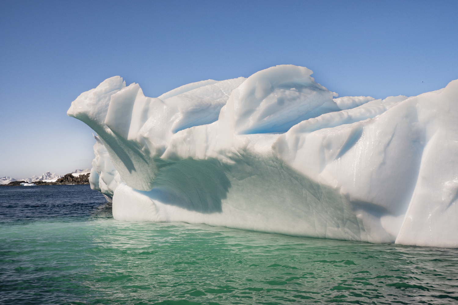
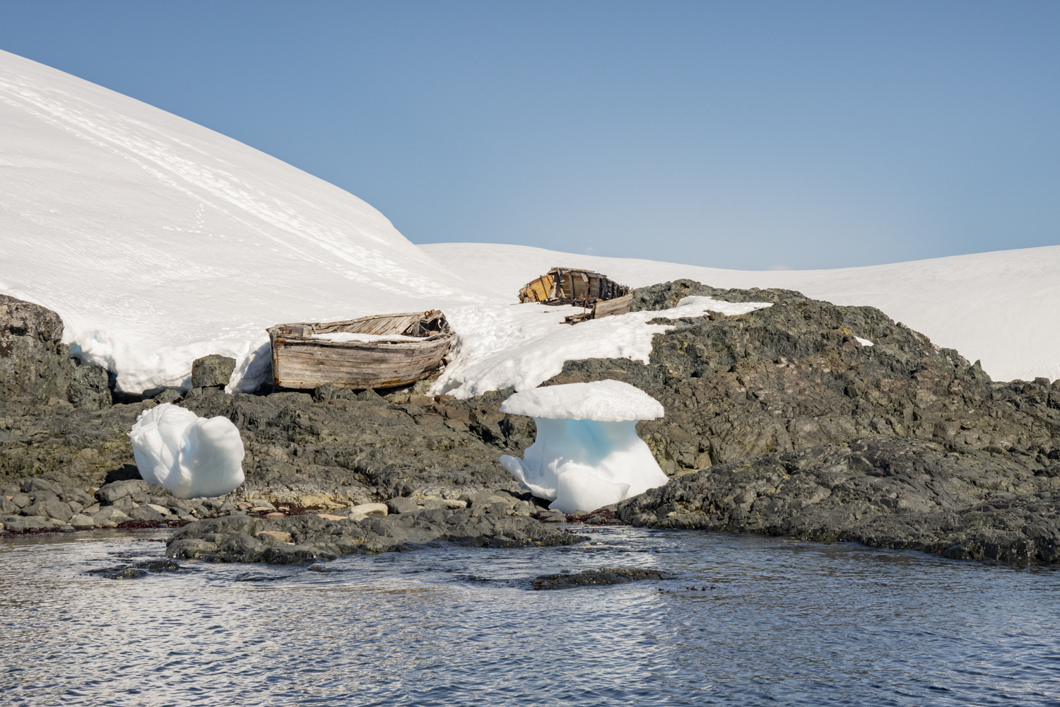
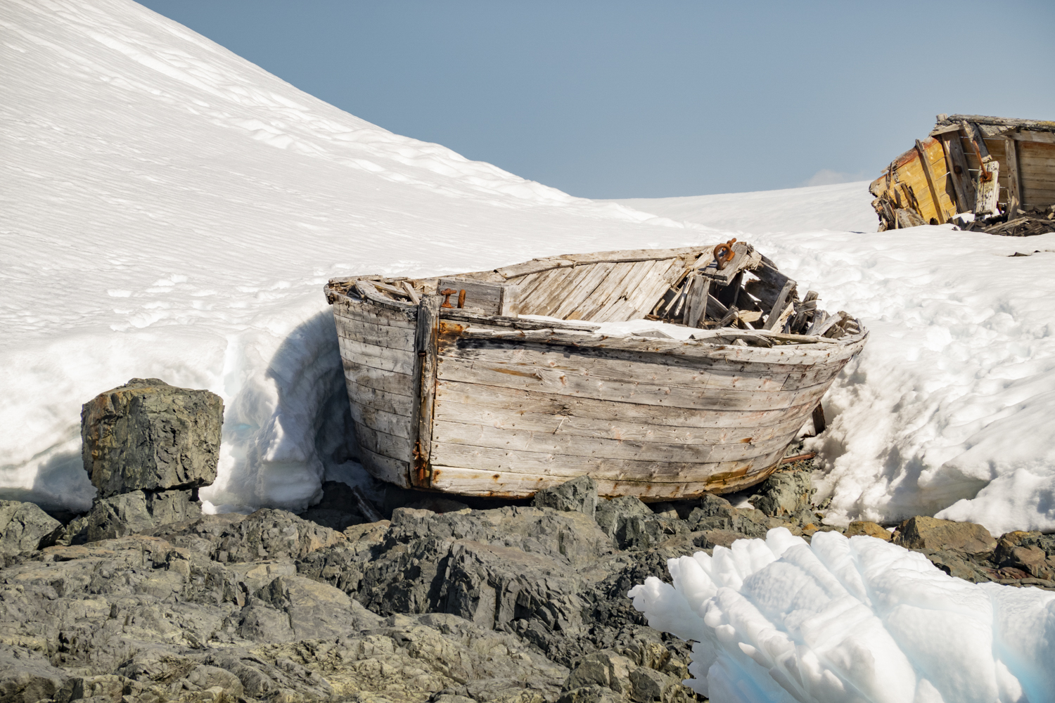
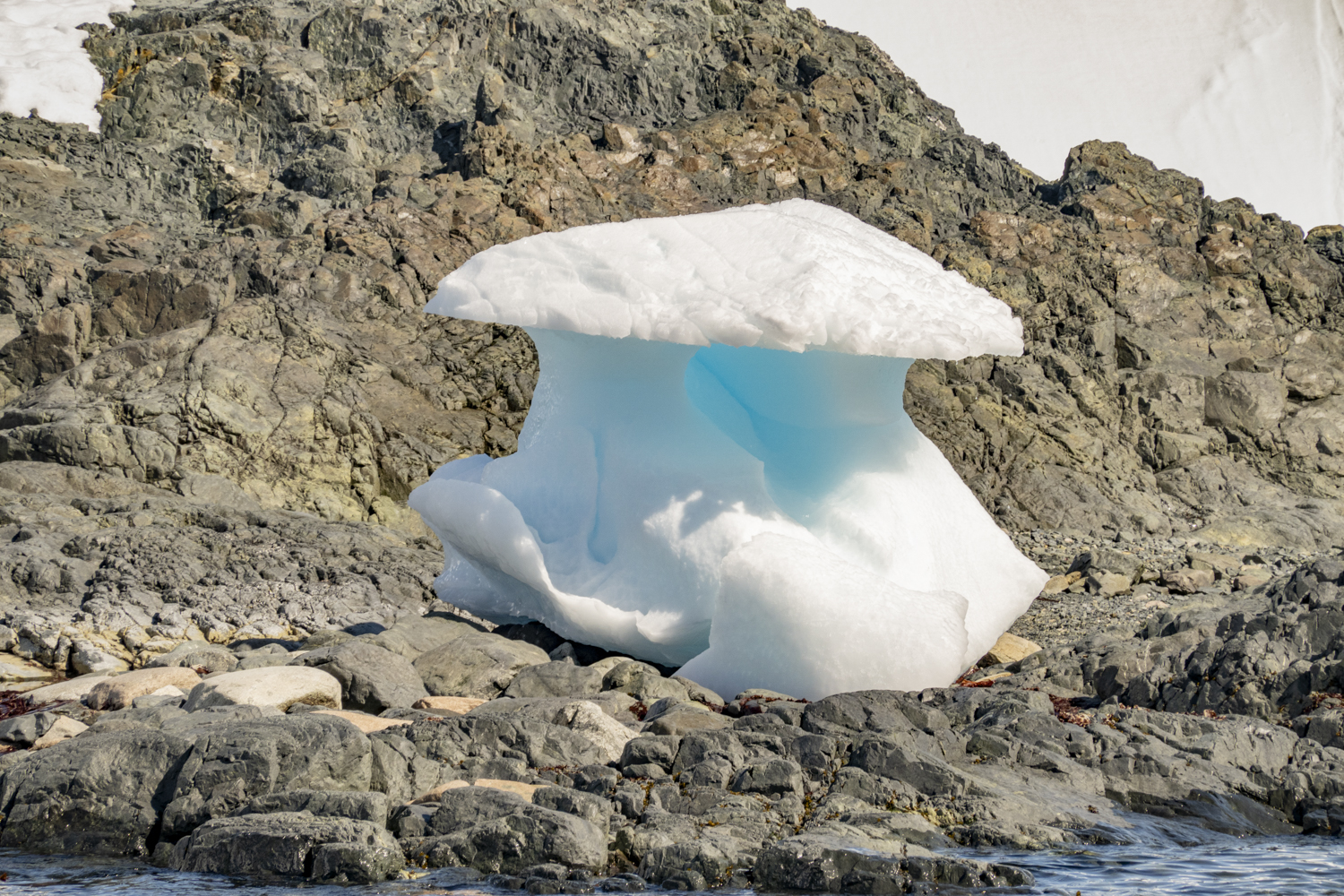
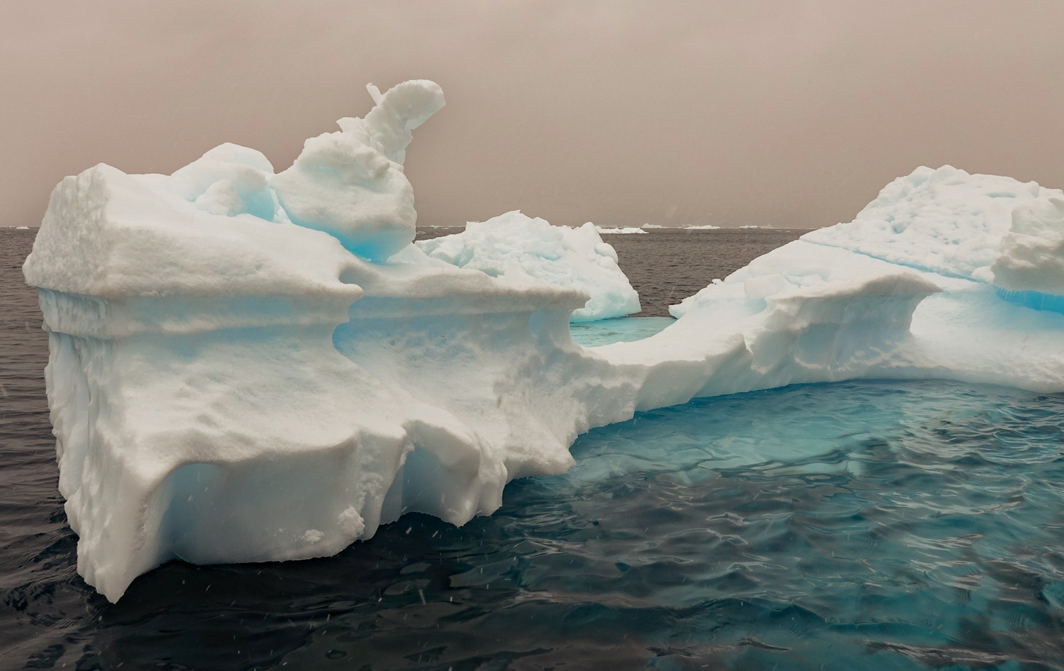
Enterprise Island, Antarctic Peninsula, Antarctica, photograph # 1 – an island in Wilhelmina Bay on the west side of Graham Land that was home to many whale oil processing ships in the early 1900s and has the wreck of the SS Guvernøren, a whale factory ship that caught fire in 1915 and was sunk in place to put out the fire in the hold; here was an unusually carved, corrugated iceberg
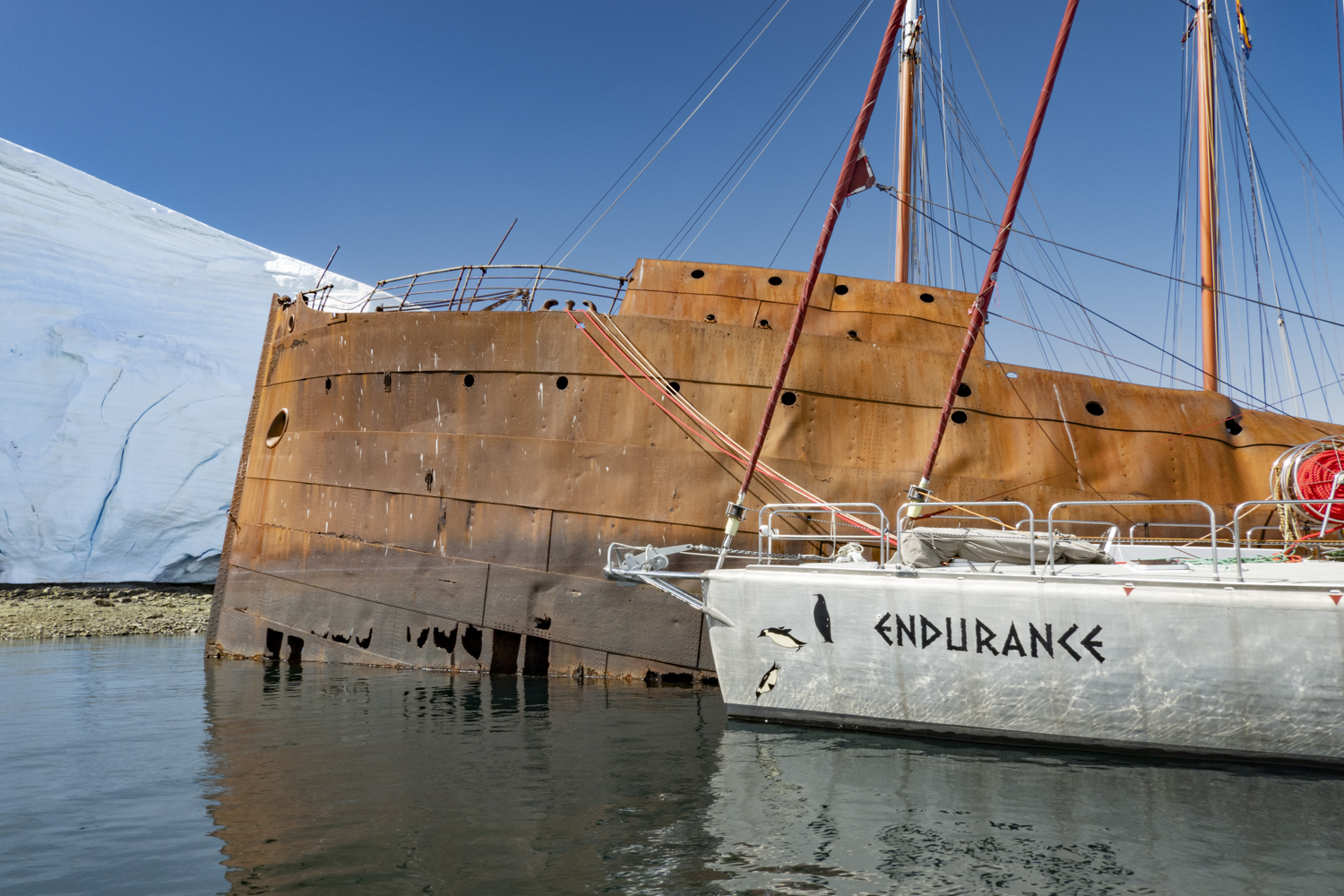
From Wilhelmina Bay we sailed mid-day to reach an anchorage off Enterprise Island. The island, 2.5 kilometers (1.6 miles) long, is located off the Danco coast of Graham Land in the north of the Antarctic Peninsula (in Wilhelmina Bay off the northern end of Nansen Island). Enterprise Island was charted during the Belgian Antarctic Expedition under Adrien de Gerlache in 1898, and the two islands – Elephant Island and Nansen Island – were charted together as one feature and named “Ile Nansen”. It was then known to whalers who operated in this region in the 1900s. whose enterprise led the United Kingdom Antarctic Place-names Committee to commemorate their enterprise with the eponymous name for the island. This area also features the wreck of the SS Guvernøren, a whale factory ship that caught fire in 1915. Today, the ship’s bow and bridge are above water, reclaimed by nature, and colonized by Antarctic Terns.
Enterprise Island, Antarctic Peninsula, Antarctica, photograph # 2 – another perspective of the unusually carved, corrugated icebergEnterprise Island, Antarctic Peninsula, Antarctica, photograph # 3Enterprise Island, Antarctic Peninsula, Antarctica, photograph # 4 — the wreck of the SS Guvernøren with two contemporary sailing yachts moored alongside after sailing to the Antarctic Peninsula from southern Argentina (one ship is from Argentina, the other is Russian)
“The GUVERNØREN was shipwrecked back in 1915 on January 27th after she caught on fire during a crew party, where the story goes that someone bumped a burning lantern off a table. A more comprehensive story is that the crew were celebrating a successful 1914-15 whaling season on the Antarctic peninsula with 5,050 cubic meters [178,339 cubic feet] of whale oil stored in her hull. Once she did catch fire all attempts to put the fire out failed, which included them firing explosive harpoons into the hull to partially sink her so that the ocean would put the fire out in order to save the cargo. However, all the cargo was lost BUT none of the 83 crew lost their lives, which is quite remarkable considering the remote area.” — https://steemit.com/history/@thomasjmitchell/guvernoren-shipwreck-at-enterprise-island
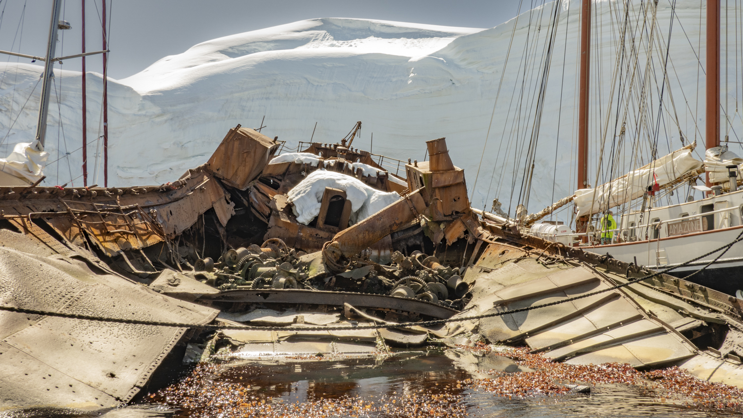
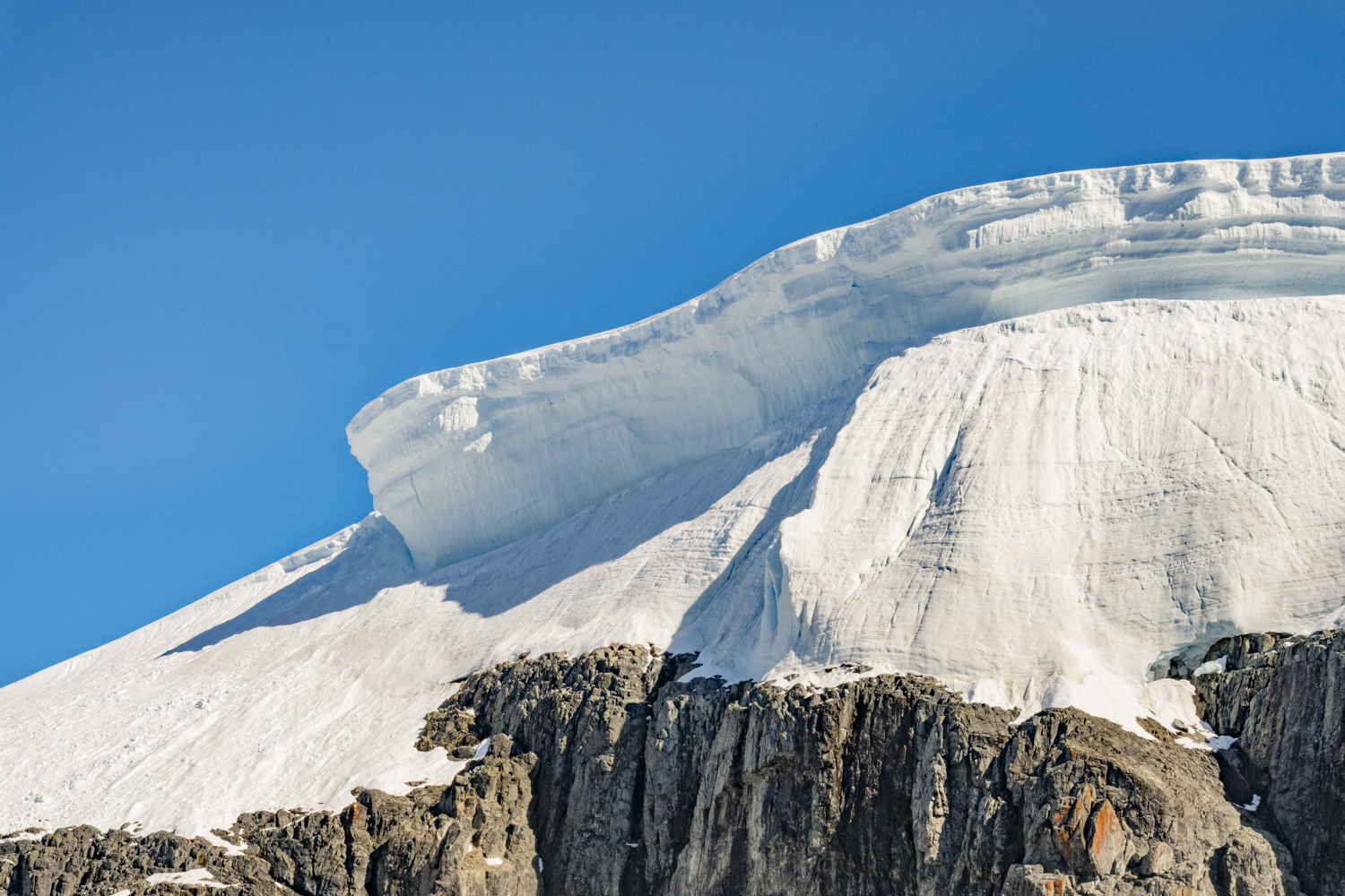
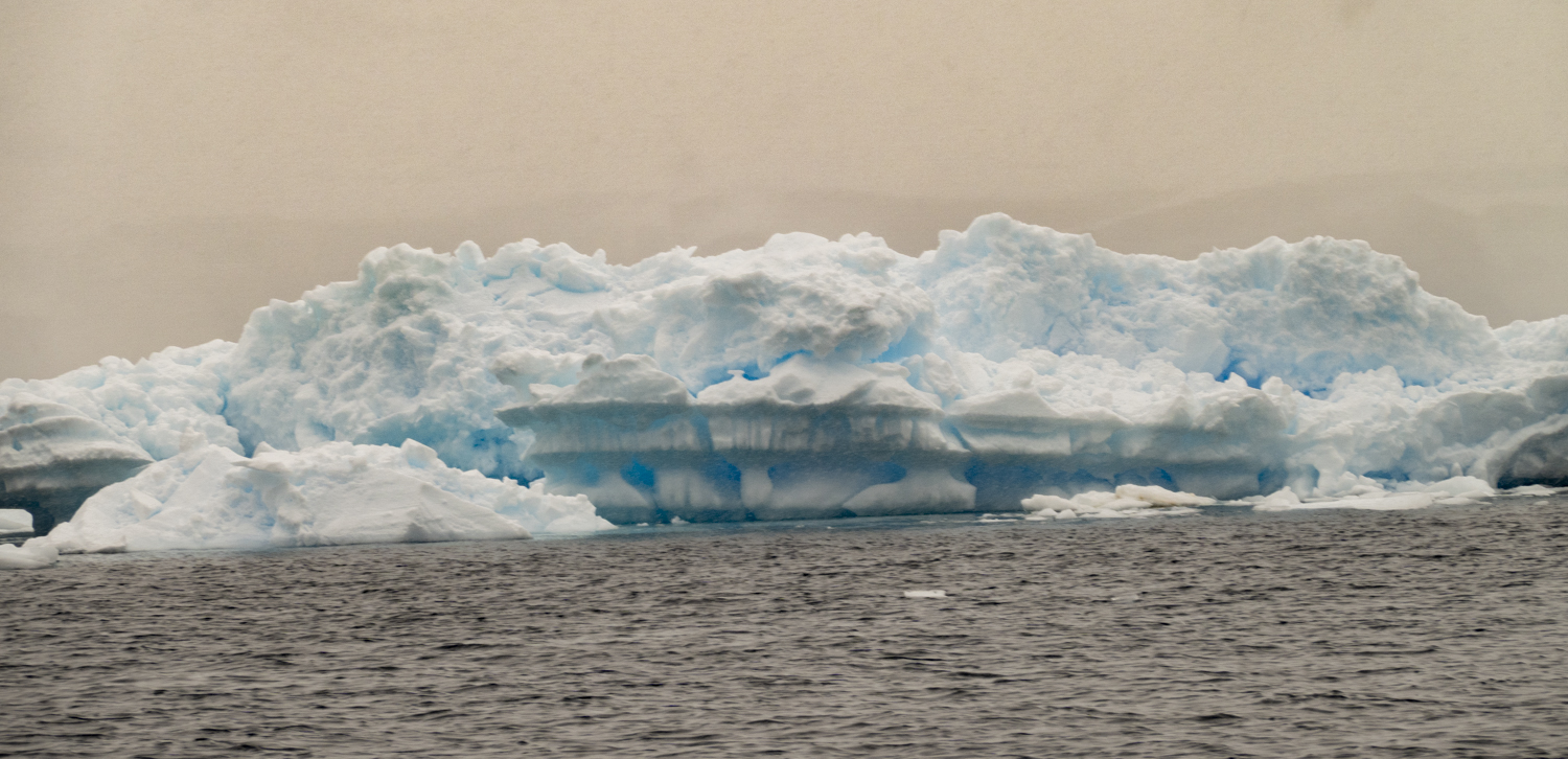
Enterprise Island, Antarctic Peninsula, Antarctica, photograph # 5Enterprise Island, Antarctic Peninsula, Antarctica, photograph # 6 – much of the oil processing equipment remains in place on the foredeck of the partially sunken SS GuvernørenEnterprise Island, Antarctic Peninsula, Antarctica, photograph # 7Enterprise Island, Antarctic Peninsula, Antarctica, photograph # 8 – two water boats used to collect fresh water dripping off the icebergs for use in processing the whales on the whale oil factory shipsEnterprise Island, Antarctic Peninsula, Antarctica, photograph # 9 – a close up of the water boats used to collect fresh waterEnterprise Island, Antarctic Peninsula, Antarctica, photograph # 10 – a fresh mushroom near the water boatsEnterprise Island, Antarctic Peninsula, Antarctica, photograph # 11 – red colored sea kelp at the base of the island under a canopy of snowEnterprise Island, Antarctic Peninsula, Antarctica, photograph # 12 – many of the icebergs around the island showed heavy wave and weather erosionEnterprise Island, Antarctic Peninsula, Antarctica, photograph # 13 – a stunning cornice, a reminder to downhill skiers of what we are missing sitting in a Zodiac and absorbing the fabulous scenery
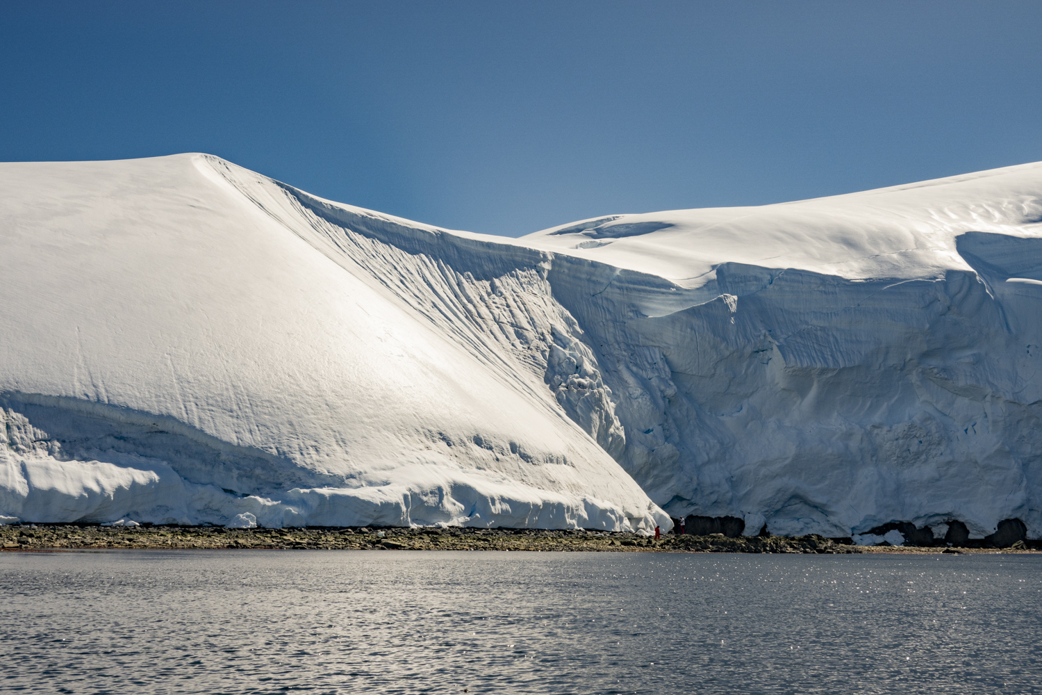
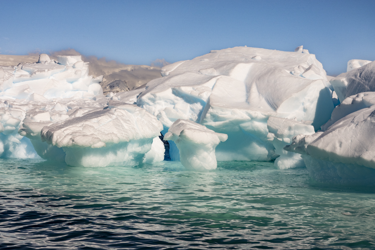
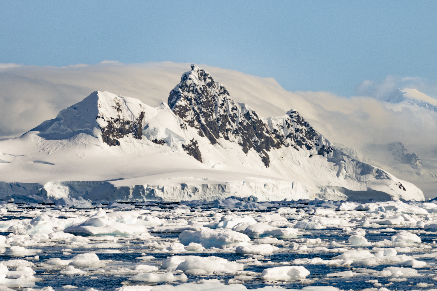
Wilhelmina Bay II, Antarctic Peninsula, Antarctica, photograph # 1 – on this visit to the bay, we had a bright, sunny day with low winds to cruise the bay’s collection of coves, glaciers, snow-covered islands and wildlife
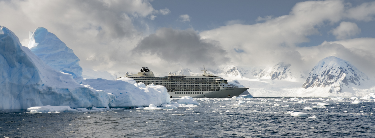
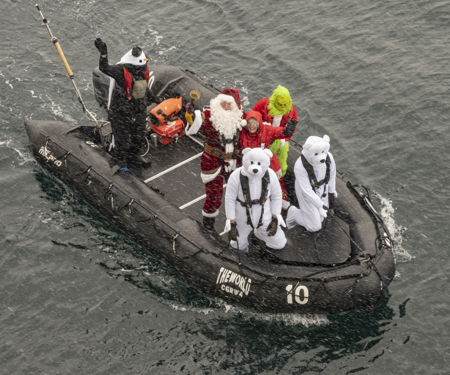
From the southernmost point on this Antarctica expedition at Red Rock Bluff, we turned around to start our northern journey back along the west coast of the Antarctic Peninsula. We made good progress sailing overnight and managed to avoid a huge storm (with winds gusting up to 100 knots) and found shelter in the late morning in Wilhelmina Bay (visited a few weeks before on the prior expedition). Unlike the snowy visit on Christmas Day 2023, when Santa Claus did manage to find our GPS coordinates and flew his reindeer and sleigh to the area (and then boarded our ship to distribute gifts to all the good children on board), this time our Zodiac cruising was on a bright, sunny day with low winds.
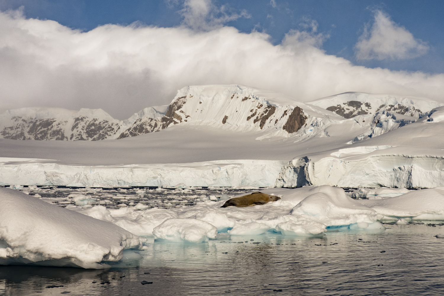
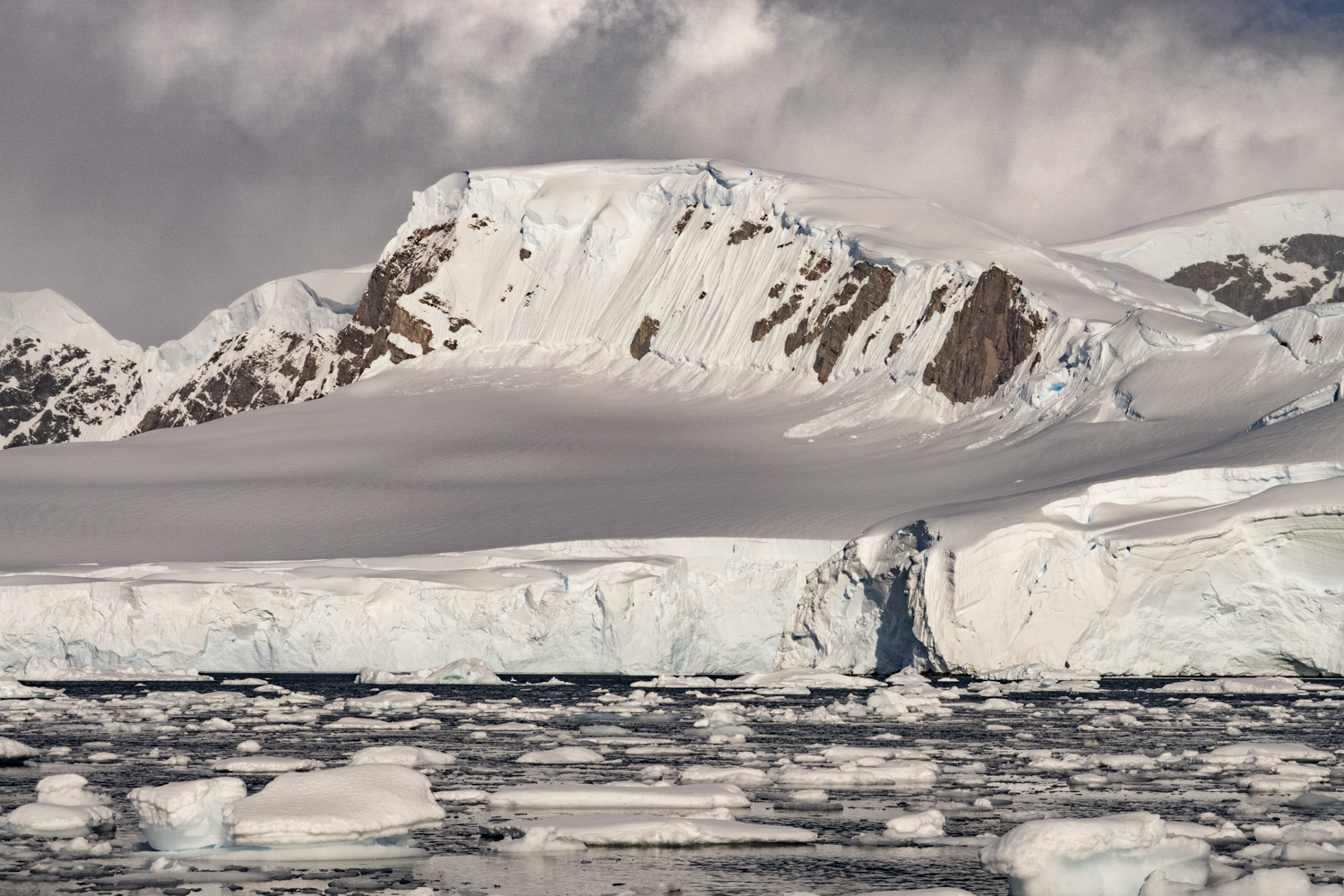
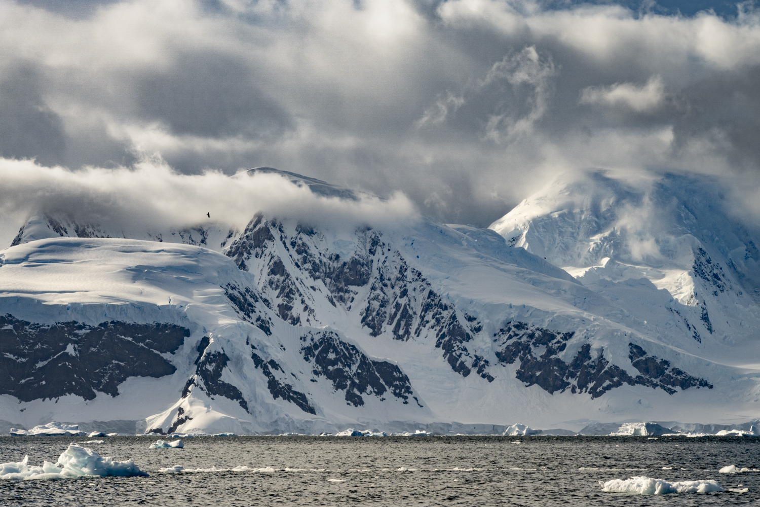
Wilhelmina Bay is a collection of coves, glaciers and snow-covered islands. In the winter, these waters would be covered by sea ice which opens during spring, allowing vessels to explore this amazing landscape. Wilhelmina Bay is named after the Queen of the Netherlands, who reigned from 1890 to 1948.
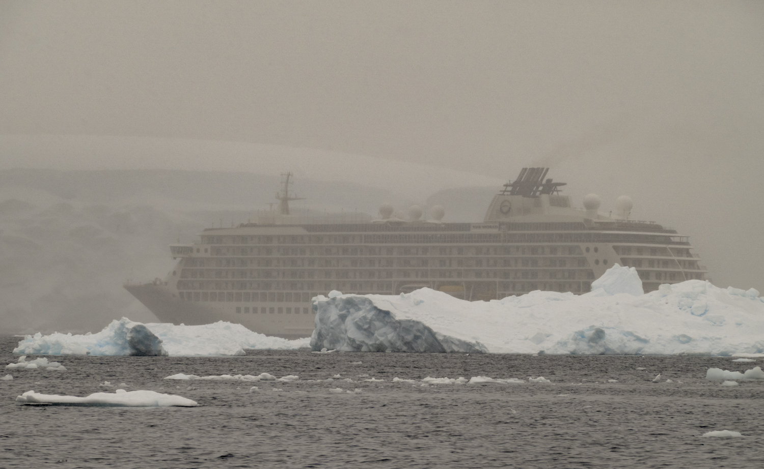
Wilhelmina Bay II, Antarctic Peninsula, Antarctica, photograph # 2 – shortly after leaving the ship, our Zodiac driver spotted a crabeater seal on an ice floeWilhelmina Bay II, Antarctic Peninsula, Antarctica, photograph # 3 – a close up of the crabeater seal on an ice floeWilhelmina Bay II, Antarctic Peninsula, Antarctica, photograph # 4 – anyone for helicopter skiing?Wilhelmina Bay II, Antarctic Peninsula, Antarctica, photograph # 5Wilhelmina Bay II, Antarctic Peninsula, Antarctica, photograph # 6Wilhelmina Bay II, Antarctic Peninsula, Antarctica, photograph # 7Wilhelmina Bay II, Antarctic Peninsula, Antarctica, photograph # 8Wilhelmina Bay II, Antarctic Peninsula, Antarctica, photograph # 9 – our ship appeared to play hide-and-seek amidst the icebergs all morningWilhelmina Bay II, Antarctic Peninsula, Antarctica, photograph # 10 – one for the money, two for the show – 2 crabeater seals sharing an icebergWilhelmina Bay II, Antarctic Peninsula, Antarctica, photograph # 11 – a close up of the 2 crabeater seals sharing an icebergWilhelmina Bay II, Antarctic Peninsula, Antarctica, photograph # 12 – a lone skua was caught flying toward us from the mountain
Wilhelmina Bay, Antarctic Peninsula, Antarctica, photograph # 1 – on Christmas morning, we explored the glacially-carved icebergs and vistas of towering peaks on 20-foot (6 meter) rigid inflatable Zodiac boats, wondering if Santa Claus would be able to fly in from the North Pole in the inclement weather with poor visibility
From the South Shetland Islands and the “iceberg alley”, we sailed overnight and reached our first anchorage point on the Antarctic Peninsula, Wilhelmina Bay, on a very snowy Christmas morning, giving us a “white Christmas”. Wilhelmina Bay is a collection of coves, glaciers and snow-covered islands. In the winter, these waters would be covered by sea ice which opens during spring, allowing vessels to explore this amazing landscape. Wilhelmina Bay is named after the Queen of the Netherlands, who reigned from 1890 to 1948.
Wilhelmina Bay, Antarctic Peninsula, Antarctica, photograph # 2Wilhelmina Bay, Antarctic Peninsula, Antarctica, photograph # 3Wilhelmina Bay, Antarctic Peninsula, Antarctica, photograph # 4Wilhelmina Bay, Antarctic Peninsula, Antarctica, photograph # 5Wilhelmina Bay, Antarctic Peninsula, Antarctica, photograph # 6
Wilhelmina Bay, Antarctic Peninsula, Antarctica, photograph # 7
Wilhelmina Bay, Antarctic Peninsula, Antarctica, photograph # 7Wilhelmina Bay, Antarctic Peninsula, Antarctica, photograph # 8Wilhelmina Bay, Antarctic Peninsula, Antarctica, photograph # 9Wilhelmina Bay, Antarctic Peninsula, Antarctica, photograph # 10 – thanks to Santa having upgraded the navigation equipment on his sled, he was able to find our GPS coordinates and his reindeer guided him and his presents for children to an ice field near where our ship was anchored; our alert captain and bridge team saw a strange object on the ship’s radar, visually identified the reindeer and sled, and then dispatched a Zodiac to bring Santa Claus, Mrs. Claus and the Grinch to our ship where he greatly surprised all the children aboard